L’articolo è stato aggiunto alla lista dei desideri


LIBRO INGLESE

 E-mail
 Facebook
 LinkedIn
 Twitter
 WhatsApp
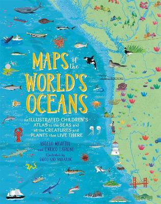
Maps of the World's Oceans: An Illustrated Children's Atlas to the Seas and all the Creatures and Plants that Live There
(0)
Cliccando su “Conferma” dichiari che il contenuto da te inserito è conforme alle Condizioni Generali d’Uso del Sito ed alle Linee Guida sui Contenuti Vietati. Puoi rileggere e modificare e successivamente confermare il tuo contenuto. Tra poche ore lo troverai online (in caso contrario verifica la conformità del contenuto alle policy del Sito).
Grazie per la tua recensione!
Tra poche ore la vedrai online (in caso contrario verifica la conformità del testo alle nostre linee guida). Dopo la pubblicazione per te +4 punti ![]()
23,75 €

-5%
25,00 €
+240
punti
Venditore: IBS
Articolo acquistabile con Bonus Cultura 18app e Carta del Docente


Articolo acquistabile con Carta Cultura Giovani e Carta del Merito

Dati e Statistiche
 Salvato in 0 liste dei desideri
Maps of the World's Oceans: An Illustrated Children's Atlas to the Seas and all the Creatures and Plants that Live There
Disponibile in 5 giorni lavorativi
23,75 €
-5%
25,00 €
23,75 €
25,00 €
-5%
Disp. in 5 gg lavorativi

Maps of the World's Oceans: An Illustrated Children's Atlas to the Seas and all the Creatures and Plants that Live There
Libri in Inglese
Altri venditori
Prezzo e spese di spedizione

Venduto e spedito da IBS
23,75 €
Spedizione gratuita
Altri venditori
Prezzo e spese di spedizione
Venduto e spedito da IBS
23,75 €
Spedizione gratuita
Altri venditori
Prezzo e spese di spedizione
Tutti i formati ed edizioni
Promo attive (0)
This lavishly illustrated, fact-filled atlas-a follow-up to Maps of the World-allows children to discover the fascinating and mysterious world below sea level. Covering every ocean and major sea in the world, MAPS OF THE WORLD'S OCEANS is a vibrant and comprehensive atlas that children of all ages will love to explore. The dozens of colourful, detailed maps are filled with hundreds of illustrated icons highlighting creatures that inhabit the waters of the world from deep-ocean sharks to sea birds that rely on the water to survive. Also featured are vital vegetation, submerged shipwrecks and icons representing the myths and legends of the various peoples who supposedly lived by the seas. Along the surface, readers will explore ports, lighthouses, famous explorers and voyages, old navigation secrets and more. Flip the next page from any map and the corresponding icon key explains why these fish, animals, various organisms and more are so vital to the oceans and the seas - and therefore the world. Young readers will learn about waves and tides, currents and oceanic ridges and more giving them a complete look at the world's waters. Each map includes a link allowing kids to download a version of them on computers and tablets to explore even further. Captivating and comprehensive, MAPS OF THE WORLD'S OCEANS will entice even the most reluctant young explorer.
Leggi di più
Leggi di meno
Autore:
Illustratore:
Editore:
Anno:
2019
Rilegatura:
Hardback
Pagine:
144 p.
Testo in English
Dimensioni:
296 x 236 mm
Peso:
997 gr.
EAN:
9780762467976


L'articolo è stato aggiunto al carrello
L’articolo è stato aggiunto alla lista dei desideri