L’articolo è stato aggiunto alla lista dei desideri


LIBRO INGLESE

 E-mail
 Facebook
 LinkedIn
 Twitter
 WhatsApp
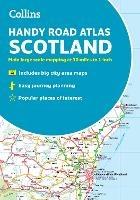
Collins Handy Road Atlas Scotland: A5 Paperback
(0)
Cliccando su “Conferma” dichiari che il contenuto da te inserito è conforme alle Condizioni Generali d’Uso del Sito ed alle Linee Guida sui Contenuti Vietati. Puoi rileggere e modificare e successivamente confermare il tuo contenuto. Tra poche ore lo troverai online (in caso contrario verifica la conformità del contenuto alle policy del Sito).
Grazie per la tua recensione!
Tra poche ore la vedrai online (in caso contrario verifica la conformità del testo alle nostre linee guida). Dopo la pubblicazione per te +4 punti ![]()
8,30 €

-5%
8,74 €
+80
punti
Venditore: IBS
Articolo acquistabile con Bonus Cultura 18app e Carta del Docente


Articolo acquistabile con Carta Cultura Giovani e Carta del Merito

Dati e Statistiche
 Salvato in 0 liste dei desideri
Collins Handy Road Atlas Scotland: A5 Paperback
Disponibile in 5 giorni lavorativi
8,30 €
-5%
8,74 €
8,30 €
8,74 €
-5%
Disp. in 5 gg lavorativi

Collins Handy Road Atlas Scotland: A5 Paperback
Libri in Inglese
Altri venditori
Prezzo e spese di spedizione

Venduto e spedito da IBS
8,30 €
Spedizione gratuita
Altri venditori
Prezzo e spese di spedizione
Venduto e spedito da IBS
8,30 €
Spedizione gratuita
Altri venditori
Prezzo e spese di spedizione
Tutti i formati ed edizioni
Promo attive (0)
Discover new places with handy road atlases from Collins. Your ideal companion for navigating around Scotland. It has extremely clear, route planning maps of Scotland, detailed city plans of the major cities and towns and fits neatly into your glovebox, briefcase or bag. Main features Clear, attractive route planning maps of the whole of Scotland supported by comprehensive, fully indexed city centre street maps of Aberdeen, Dundee, Edinburgh, Glasgow, Inverness and Perth. Scale of main maps: 1:625,000 (9.9 miles to 1 inch). Also includes • Places of tourist interest are highlighted • Attractive layer colouring showing land height • Road network fully classified and colour coded • Detailed street mapping of Edinburgh, including the Royal Mile with all its attractions clearly marked, Leith and Holyrood Park • Detailed street mapping of Glasgow, including the West End, city centre and M74 extension • Detailed street mapping of Aberdeen, including the bypass • Street maps, with indexes, of Dundee, Inverness and Perth city centres • Handy distance calculator chart highlighting distances between the major towns • Administrative areas map showing council areas • Transport connections section listing all the airports and details of all vehicle ferries into and within Scotland Area of coverage Covers the whole of Scotland and part of northern England, extending down to Kendal and Scarborough in the south.
Leggi di più
Leggi di meno
Autore:
Editore:
Anno:
2022
Rilegatura:
Paperback / softback
Pagine:
72 p.
Testo in English
Dimensioni:
210 x 148 mm
Peso:
120 gr.
EAN:
9780008447878
L'articolo è stato aggiunto al carrello
L’articolo è stato aggiunto alla lista dei desideri