L’articolo è stato aggiunto alla lista dei desideri

LIBRO INGLESE

 E-mail
 Facebook
 LinkedIn
 Twitter
 WhatsApp
2027 Collins Essential Road Atlas Britain and Northern Ireland: A4 Spiral
(0)
Cliccando su “Conferma” dichiari che il contenuto da te inserito è conforme alle Condizioni Generali d’Uso del Sito ed alle Linee Guida sui Contenuti Vietati. Puoi rileggere e modificare e successivamente confermare il tuo contenuto. Tra poche ore lo troverai online (in caso contrario verifica la conformità del contenuto alle policy del Sito).
Grazie per la tua recensione!
Tra poche ore la vedrai online (in caso contrario verifica la conformità del testo alle nostre linee guida). Dopo la pubblicazione per te +4 punti ![]()
17,80 €

-5%
18,74 €
+180
punti
Venditore: IBS
Articolo acquistabile con Carta del Docente

Articolo acquistabile con Carta Cultura Giovani e Carta del Merito

Articolo acquistabile con Carta della Cultura

Dati e Statistiche
 Salvato in 0 liste dei desideri
2027 Collins Essential Road Atlas Britain and Northern Ireland: A4 Spiral
Disponibile in 5 gg lavorativi
17,80 €
-5%
18,74 €
17,80 €
18,74 €
-5%
Disponibile in 5 gg lavorativi
Altre offerte vendute e spedite dai nostri venditori
Libri in Inglese
2027 Collins Essential Road Atlas Britain and Northern Ireland: A4 Spiral
Altri venditori
Prezzo e spese di spedizione
LIBRO INGLESE
Disponibile in 5 gg lavorativi

Venduto e spedito da
IBS
Spedizione Gratis
-5%
18,74 €
17,80 €
Altri venditori
Prezzo e spese di spedizione
LIBRO INGLESE
Disponibile in 5 gg lavorativi
Venduto e spedito da
IBS
Spedizione Gratis
-5%
18,74 €
17,80 €
Altri venditori
Prezzo e spese di spedizione
Tutti i formati ed edizioni
Promo attive (0)
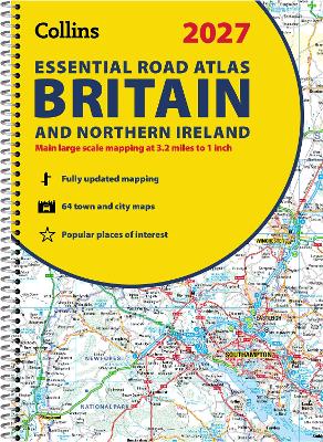
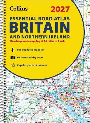
Explore Britain with easy-to-read mapping from Collins. This A4, spiral-bound road atlas provides clear and detailed road mapping for England, Wales and Southern Scotland at a scale of 3.2 miles to 1 inch (1:200,000). For Northern Scotland the mapping is at a scale of 4.2 miles to 1 inch (1:266,000), with land height shown by different layers of colouring. Main features: Route-planning section including maps at a scale of 22 miles to 1 inch, motorway services information, and a handy distance calculator chart More than 20 urban approach maps at a larger scale which clearly show the best routes through and into built-up areas 64 street maps focused on town centres showing places of interest, car park locations and one-way streets. All the street maps are fully indexed Over 30 categories of places of interest including castles, theme parks, sports venues, universities, mountain bike trails and surfing beaches The top 1000 most visited places of interest are indexed with full postcodes to aid integration with sat-nav systems Updated Park & Ride locations, new rail stations and extensions to tram lines in Blackpool and Edinburgh Now includes dual Welsh / English names for Welsh locations, for example, Caerdydd / Cardiff This is the ideal purchase for drivers, navigators and route planners who want the very best road atlas of Britain in an A4 format.
Leggi di più
Leggi di meno
Autore:
Editore:
Collana:
Collins Road Atlas
Anno:
2026
Rilegatura:
Spiral bound
Pagine:
344 p.
Testo in English
Dimensioni:
297 x 210 mm
Peso:
1020 gr.
EAN:
9780008779030
L'articolo è stato aggiunto al carrello
Informazioni e Contatti sulla Sicurezza dei Prodotti
Le schede prodotto sono aggiornate in conformità al Regolamento UE 988/2023. Laddove ci fossero taluni dati non disponibili per ragioni indipendenti da IBS, vi informiamo che stiamo compiendo ogni ragionevole sforzo per inserirli. Vi invitiamo a controllare periodicamente il sito www.ibs.it per eventuali novità e aggiornamenti.
Per le vendite di prodotti da terze parti, ciascun venditore si assume la piena e diretta responsabilità per la commercializzazione del prodotto e per la sua conformità al Regolamento UE 988/2023, nonché alle normative nazionali ed europee vigenti.
Per informazioni sulla sicurezza dei prodotti, contattare productsafetyibs@feltrinelli.it
L’articolo è stato aggiunto alla lista dei desideri