L’articolo è stato aggiunto alla lista dei desideri
LIBRO INGLESE

 E-mail
 Facebook
 LinkedIn
 Twitter
 WhatsApp
2300 Dorset and Devon Coasts Chart Pack
(0)
Cliccando su “Conferma” dichiari che il contenuto da te inserito è conforme alle Condizioni Generali d’Uso del Sito ed alle Linee Guida sui Contenuti Vietati. Puoi rileggere e modificare e successivamente confermare il tuo contenuto. Tra poche ore lo troverai online (in caso contrario verifica la conformità del contenuto alle policy del Sito).
Grazie per la tua recensione!
Tra poche ore la vedrai online (in caso contrario verifica la conformità del testo alle nostre linee guida). Dopo la pubblicazione per te +4 punti ![]()
71,19 €

-5%
74,94 €
+710
punti
Venditore: IBS
Articolo acquistabile con Carta del Docente

Articolo acquistabile con Carta Cultura Giovani e Carta del Merito

Articolo acquistabile con Carta della Cultura

Paga con Klarna in 3 rate senza interessi per ordini superiori a 39 €

Dati e Statistiche
 Salvato in 0 liste dei desideri
2300 Dorset and Devon Coasts Chart Pack
Disponibile in 5 gg lavorativi
71,19 €
-5%
74,94 €
71,19 €
74,94 €
-5%
Disponibile in 5 gg lavorativi
Altre offerte vendute e spedite dai nostri venditori

Libri in Inglese
2300 Dorset and Devon Coasts Chart Pack
Altri venditori
Prezzo e spese di spedizione

Nuovo
Disponibile in 5 gg lavorativi

Venduto e spedito da
IBS
Spedizione Gratis
-5%
74,94 €
71,19 €
Altri venditori
Prezzo e spese di spedizione
Nuovo
Disponibile in 5 gg lavorativi
Venduto e spedito da
IBS
Spedizione Gratis
-5%
74,94 €
71,19 €
Altri venditori
Prezzo e spese di spedizione
Tutti i formati ed edizioni

Promo attive (0)
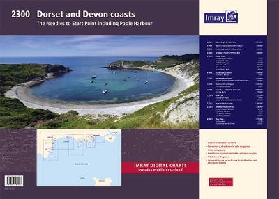
A convenient A2 format chart pack of Dorset and Devon Coasts covering waters from the River Dart to the western approaches to The Solent. The pack is provided in a sturdy plastic wallet. This fully revised and extended edition of our popular 2300 Dorset and Devon Coasts chart pack has been redesigned and expanded to 13 sheets and includes improved coastal coverage throughout. The latest official UKHO Digital has been used and combined with additional information sourced from Imray's network to make it ideal for small craft. The chart pack includes all the navigational charts and tidal Digital for passage, approach, and mooring, and is designed to be used alongside The Shell Channel Pilot by Tom Cunliffe. 2300.1 Isle of Wight to Start Point (1:375 000) 2300.2 Western Approaches to the Solent (1:60 000) 2300.3 Poole Harbour to St Alban's Head (1:60 000) 2300.4 St Alban's Head to Portland Bill (1:60 000) 2300.5 Dorset Plans Plans: Weymouth Harbour (1:7500), Lulworth Cove (1:4500), Worbarrow Bay (1:15 000), Swanage Bay (1:12 500), Portland Harbour (1:20 000), Chapman's Pool (1:14 500) 2300.6 Poole Harbour (East) (1:17 000) Plan: Salterns Marina (1:7500) 2300.7 Poole Harbour (West) (1:17 000) Plan: Poole Harbour continuation of Holes Bay (1:17 000) 2300.8 Portland Bill to Bridport (1:100 000) Plan: Bridport Harbour (1:5000) 2300.9 Lyme Bay - Bridport to Exmouth (1:100 000) Plan: Lyme Regis (1:10 000) 2300.10 River Exe (1:21 500) Plans: Exmouth Dock (1:7500), River Exe continuation to Exeter (1:21 500) 2300.11 Exmouth to Salcombe (1:100 000) 2300.12 Teignmouth & Tor Bay (1:50 000) Plan: Teignmouth Harbour (1:12 500), Torquay Harbour (1:7700), Paignton Harbour (1:7500), Brixham Harbour (1:10 000) 2300.13 River Dart (1:15 000) Plans: Kingswear (1:6250), River Dart continuation to Totnes (1:27 500)
Leggi di più
Leggi di meno
Autore:
Editore:
Anno:
2023
Rilegatura:
Sheet map, flat
Pagine:
13 p.
Testo in English
Dimensioni:
594 x 420 mm
Peso:
660 gr.
EAN:
9781786794543
L'articolo è stato aggiunto al carrello
Informazioni e Contatti sulla Sicurezza dei Prodotti
Le schede prodotto sono aggiornate in conformità al Regolamento UE 988/2023. Laddove ci fossero taluni dati non disponibili per ragioni indipendenti da IBS, vi informiamo che stiamo compiendo ogni ragionevole sforzo per inserirli. Vi invitiamo a controllare periodicamente il sito www.ibs.it per eventuali novità e aggiornamenti.
Per le vendite di prodotti da terze parti, ciascun venditore si assume la piena e diretta responsabilità per la commercializzazione del prodotto e per la sua conformità al Regolamento UE 988/2023, nonché alle normative nazionali ed europee vigenti.
Per informazioni sulla sicurezza dei prodotti, contattare productsafetyibs@feltrinelli.it
L’articolo è stato aggiunto alla lista dei desideri