L’articolo è stato aggiunto alla lista dei desideri

LIBRO INGLESE

 E-mail
 Facebook
 LinkedIn
 Twitter
 WhatsApp
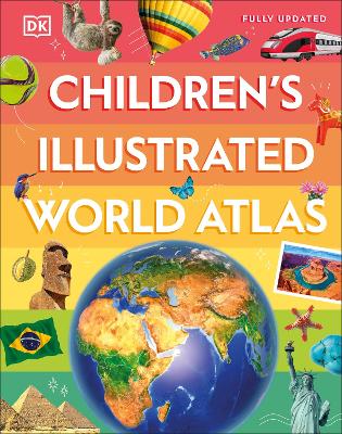
Children's Illustrated World Atlas
(0)
Cliccando su “Conferma” dichiari che il contenuto da te inserito è conforme alle Condizioni Generali d’Uso del Sito ed alle Linee Guida sui Contenuti Vietati. Puoi rileggere e modificare e successivamente confermare il tuo contenuto. Tra poche ore lo troverai online (in caso contrario verifica la conformità del contenuto alle policy del Sito).
Grazie per la tua recensione!
Tra poche ore la vedrai online (in caso contrario verifica la conformità del testo alle nostre linee guida). Dopo la pubblicazione per te +4 punti ![]()
17,80 €

-5%
18,74 €
+180
punti
Venditore: IBS
Articolo acquistabile con Carta del Docente

Articolo acquistabile con Carta Cultura Giovani e Carta del Merito

Articolo acquistabile con Carta della Cultura

Dati e Statistiche
 Salvato in 0 liste dei desideri
Children's Illustrated World Atlas
Disponibile in 5 gg lavorativi
17,80 €
-5%
18,74 €
17,80 €
18,74 €
-5%
Disponibile in 5 gg lavorativi
Altre offerte vendute e spedite dai nostri venditori

Libri in Inglese
Children's Illustrated World Atlas
Altri venditori
Prezzo e spese di spedizione
Nuovo
Disponibile in 5 gg lavorativi

Venduto e spedito da
IBS
Spedizione Gratis
-5%
18,74 €
17,80 €
Altri venditori
Prezzo e spese di spedizione
Nuovo
Disponibile in 5 gg lavorativi
Venduto e spedito da
IBS
Spedizione Gratis
-5%
18,74 €
17,80 €
Altri venditori
Prezzo e spese di spedizione
Tutti i formati ed edizioni

Promo attive (0)
Take young readers on the ultimate round-the-world trip with this impressive atlas - packed full of beautiful illustrations and photographs. Discover the world map-by-map with this exciting world atlas book for children, featuring more than 50 maps! Each page is filled with fascinating information, facts and colourful illustrations of our world. Children aged 9-12 will love to learn all about the many countries, cultures and people of the world through vibrant maps. Fascinating facts, local stories, vivid pictures, and clear, satellite-based maps together make this atlas a global yet personal experience for young readers. This illustrated atlas book for children offers: - Bite-sized information giving the profiles, facts, stats and flags of every country. - Pictures and stories explaining the society, culture and history of each region. - Maps created using satellite imagery providing a clear view of the world map-by-map. - A variety of topics covered, including population density, wealth, and internet access shown through graphics. From Bangkok's floating markets to the carnival in Venice, the Children's Illustrated World Atlas brings together views from windows all over the world. This illustrated atlas not only portrays regions, such as the Siberian wastes, with beautifully detailed maps but also describes the peoples who live there.
Leggi di più
Leggi di meno
Autore:
Editore:
Collana:
DK Children's Illustrated Reference
Anno:
2024
Rilegatura:
Hardback
Pagine:
144 p.
Testo in English
Dimensioni:
283 x 221 mm
Peso:
859 gr.
EAN:
9780241659014
L'articolo è stato aggiunto al carrello
Informazioni e Contatti sulla Sicurezza dei Prodotti
Le schede prodotto sono aggiornate in conformità al Regolamento UE 988/2023. Laddove ci fossero taluni dati non disponibili per ragioni indipendenti da IBS, vi informiamo che stiamo compiendo ogni ragionevole sforzo per inserirli. Vi invitiamo a controllare periodicamente il sito www.ibs.it per eventuali novità e aggiornamenti.
Per le vendite di prodotti da terze parti, ciascun venditore si assume la piena e diretta responsabilità per la commercializzazione del prodotto e per la sua conformità al Regolamento UE 988/2023, nonché alle normative nazionali ed europee vigenti.
Per informazioni sulla sicurezza dei prodotti, contattare productsafetyibs@feltrinelli.it
L’articolo è stato aggiunto alla lista dei desideri