L’articolo è stato aggiunto alla lista dei desideri


LIBRO INGLESE

 E-mail
 Facebook
 LinkedIn
 Twitter
 WhatsApp
Namibia Map: Adventure Maps
(0)
Cliccando su “Conferma” dichiari che il contenuto da te inserito è conforme alle Condizioni Generali d’Uso del Sito ed alle Linee Guida sui Contenuti Vietati. Puoi rileggere e modificare e successivamente confermare il tuo contenuto. Tra poche ore lo troverai online (in caso contrario verifica la conformità del contenuto alle policy del Sito).
Grazie per la tua recensione!
Tra poche ore la vedrai online (in caso contrario verifica la conformità del testo alle nostre linee guida). Dopo la pubblicazione per te +4 punti ![]()
14,83 €

-5%
15,61 €
+150
punti Prezzo minimo ultimi 30 giorni: 14,49 €
Venditore: IBS
Articolo acquistabile con Carta del Docente

Articolo acquistabile con Carta Cultura Giovani e Carta del Merito

Articolo acquistabile con Carta della Cultura

Dati e Statistiche
 Salvato in 0 liste dei desideri
Namibia Map: Adventure Maps
Attualmente non disponibile
14,83 €
-5%
15,61 €
14,83 €
15,61 €
-5%
Attualmente non disponibile
Altre offerte vendute e spedite dai nostri venditori
Libri in Inglese
Namibia Map: Adventure Maps
Altri venditori
Prezzo e spese di spedizione
Nuovo
Attualmente non disponibile

Venduto e spedito da
IBS
Spedizione Gratis
-5%
15,61 €
14,83 €
Altri venditori
Prezzo e spese di spedizione
Nuovo
Attualmente non disponibile
Venduto e spedito da
IBS
Spedizione Gratis
-5%
15,61 €
14,83 €
Altri venditori
Prezzo e spese di spedizione
Tutti i formati ed edizioni

Promo attive (1)
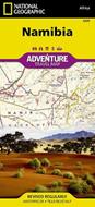
• Waterproof • Tear-Resistant • Travel MapNational Geographic's Namibia Adventure Map is designed to meet the needs of adventure travelers with its detailed and accurate information. This map includes the locations of cities and towns with a user-friendly index, a clearly marked road network complete with distances and designations for roads/highways, plus secondary routes for those seeking to explore off the beaten path. The Namibia map also includes hundreds of marked private guest lodges, camps and, state-owned rest camps. Adventure Maps differ from a traditional road map because of the specialty content they include. Each map contains hundreds of diverse and unique recreational, ecological, cultural, and historic destinations — outside of the major tourist hubs. National Geographic Adventure Maps are the perfect companion to a guidebook.Namibia is located on the south east shore of Africa. The climate is dry, even on the Atlantic coast where the dunes of the Namib Desert provide a spectacular sight. The eastern border of Namibia with Botswana, is defined by the Kalahari Desert. Despite the dry environment the protected areas of Namibia include almost 15 percent of the land area with virtually the entire Namib Desert coastal strip under protection. These protected areas are home to cheetahs, lions, zebras, giraffes, and even elephants.The northern part of the map includes the famous Skeleton Coast National Park. The the capital city of Windhoek falls in the generous overlap area of the printed map. The south side of the map includes Namib-Naukluft National Park as well as the Tsau//Khaeb (Sperrgebiet) National Park and, the long border with South Africa.Every Adventure Map is printed on durable synthetic paper, making them waterproof, tear-resistant and tough — capable of withstanding the rigors of international travel.
Leggi di più
Leggi di meno
Autore:
Editore:
Anno:
2016
Rilegatura:
Sheet map, folded
Pagine:
1 p.
Testo in English
Dimensioni:
2300 x 1100 mm
Peso:
100 gr.
EAN:
9781597756198
L'articolo è stato aggiunto al carrello
Informazioni e Contatti sulla Sicurezza dei Prodotti
Le schede prodotto sono aggiornate in conformità al Regolamento UE 988/2023. Laddove ci fossero taluni dati non disponibili per ragioni indipendenti da IBS, vi informiamo che stiamo compiendo ogni ragionevole sforzo per inserirli. Vi invitiamo a controllare periodicamente il sito www.ibs.it per eventuali novità e aggiornamenti.
Per le vendite di prodotti da terze parti, ciascun venditore si assume la piena e diretta responsabilità per la commercializzazione del prodotto e per la sua conformità al Regolamento UE 988/2023, nonché alle normative nazionali ed europee vigenti.
Per informazioni sulla sicurezza dei prodotti, contattare productsafetyibs@feltrinelli.it
L’articolo è stato aggiunto alla lista dei desideri