L’articolo è stato aggiunto alla lista dei desideri

LIBRO INGLESE

 E-mail
 Facebook
 LinkedIn
 Twitter
 WhatsApp
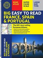
Philip's Big Easy to Read France, Spain & Portugal Road Atlas: (Traveller's edition A3 Spiral)
(0)
Cliccando su “Conferma” dichiari che il contenuto da te inserito è conforme alle Condizioni Generali d’Uso del Sito ed alle Linee Guida sui Contenuti Vietati. Puoi rileggere e modificare e successivamente confermare il tuo contenuto. Tra poche ore lo troverai online (in caso contrario verifica la conformità del contenuto alle policy del Sito).
Grazie per la tua recensione!
Tra poche ore la vedrai online (in caso contrario verifica la conformità del testo alle nostre linee guida). Dopo la pubblicazione per te +4 punti ![]()
17,80 €

-5%
18,74 €
+180
punti
Venditore: IBS
Articolo acquistabile con Carta del Docente

Articolo acquistabile con Carta Cultura Giovani e Carta del Merito

Articolo acquistabile con Carta della Cultura

Dati e Statistiche
 Salvato in 1 lista dei desideri
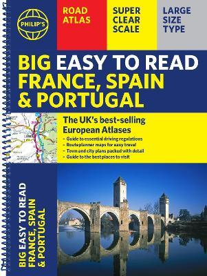
Philip's Big Easy to Read France, Spain & Portugal Road Atlas: (Traveller's edition A3 Spiral)
Disponibile in 5 gg lavorativi
17,80 €
-5%
18,74 €
17,80 €
18,74 €
-5%
Disponibile in 5 gg lavorativi
Altre offerte vendute e spedite dai nostri venditori
Libri in Inglese
Philip's Big Easy to Read France, Spain & Portugal Road Atlas: (Traveller's edition A3 Spiral)
Altri venditori
Prezzo e spese di spedizione

LIBRO INGLESE
Disponibile in 5 gg lavorativi

Venduto e spedito da
IBS
Spedizione Gratis
-5%
18,74 €
17,80 €
Altri venditori
Prezzo e spese di spedizione
LIBRO INGLESE
Disponibile in 5 gg lavorativi
Venduto e spedito da
IBS
Spedizione Gratis
-5%
18,74 €
17,80 €
Altri venditori
Prezzo e spese di spedizione
Tutti i formati ed edizioni
Promo attive (0)
The Philip's Big Easy to Read France, Spain and Portugal Road Atlas, in a large spiral bound lie-flat edition, is the must-have travelling atlas for anyone who needs the big picture for touring these countries and the adjacent countries including Belgium and Luxembourg. Scenic routes are highlighted on the road maps, with theme parks and World Heritage Sites also clearly shown. The maps highlight towns with low-emission zones and show motorway rest/parking areas, not forgetting handy listings of top sites to visit and useful ski resort information. From the market leaders in European Road Mapping, in addition to the main maps at 1:750,000, the road network is shown at three supplementary scales from 1:250,000 to 1:3M, with ultra-clear detailed maps for urban areas, so that you can navigate in this part of Europe with ease and the toll, toll-free and pre-pay motorways all clearly marked. Philip's Big Easy to Read France and Spain Road Atlas includes: * Easy to read and updated driving regulations, including speed limits; * Route-planning maps which enable journeys of over 800 miles to be planned without turning a page; * Super clear, detailed road maps, with scenic routes highlighted and toll, toll-free and pre-pay motorways all clearly marked; * Large-scale urban-area maps; * City-centre plans marking historic buildings and tourist attractions, as well as car parks, head post offices and other facilities; * Listings for ski resorts and top visitor attractions.
Leggi di più
Leggi di meno
Autore:
Editore:
Collana:
Philip's Road Atlases
Anno:
2025
Rilegatura:
Spiral bound
Pagine:
96 p.
Testo in English
Dimensioni:
388 x 288 mm
Peso:
566 gr.
EAN:
9781849077217
L'articolo è stato aggiunto al carrello
Informazioni e Contatti sulla Sicurezza dei Prodotti
Le schede prodotto sono aggiornate in conformità al Regolamento UE 988/2023. Laddove ci fossero taluni dati non disponibili per ragioni indipendenti da IBS, vi informiamo che stiamo compiendo ogni ragionevole sforzo per inserirli. Vi invitiamo a controllare periodicamente il sito www.ibs.it per eventuali novità e aggiornamenti.
Per le vendite di prodotti da terze parti, ciascun venditore si assume la piena e diretta responsabilità per la commercializzazione del prodotto e per la sua conformità al Regolamento UE 988/2023, nonché alle normative nazionali ed europee vigenti.
Per informazioni sulla sicurezza dei prodotti, contattare productsafetyibs@feltrinelli.it
L’articolo è stato aggiunto alla lista dei desideri