L’articolo è stato aggiunto alla lista dei desideri

LIBRO INGLESE

 E-mail
 Facebook
 LinkedIn
 Twitter
 WhatsApp
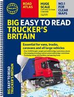
Philip's Big Easy to Read Trucker's Road Atlas Britain: Over 4,000 bridges mapped (A3 Spiral)
(0)
Cliccando su “Conferma” dichiari che il contenuto da te inserito è conforme alle Condizioni Generali d’Uso del Sito ed alle Linee Guida sui Contenuti Vietati. Puoi rileggere e modificare e successivamente confermare il tuo contenuto. Tra poche ore lo troverai online (in caso contrario verifica la conformità del contenuto alle policy del Sito).
Grazie per la tua recensione!
Tra poche ore la vedrai online (in caso contrario verifica la conformità del testo alle nostre linee guida). Dopo la pubblicazione per te +4 punti ![]()
21,37 €

-5%
22,49 €
+210
punti
Venditore: IBS
Articolo acquistabile con Carta del Docente

Articolo acquistabile con Carta Cultura Giovani e Carta del Merito

Articolo acquistabile con Carta della Cultura

Dati e Statistiche
 Salvato in 0 liste dei desideri
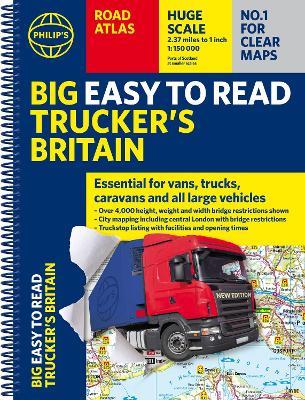
Philip's Big Easy to Read Trucker's Road Atlas Britain: Over 4,000 bridges mapped (A3 Spiral)
Disponibile in 5 gg lavorativi
21,37 €
-5%
22,49 €
21,37 €
22,49 €
-5%
Disponibile in 5 gg lavorativi
Altre offerte vendute e spedite dai nostri venditori
Libri in Inglese
Philip's Big Easy to Read Trucker's Road Atlas Britain: Over 4,000 bridges mapped (A3 Spiral)
Altri venditori
Prezzo e spese di spedizione

LIBRO INGLESE
Disponibile in 5 gg lavorativi

Venduto e spedito da
IBS
Spedizione Gratis
-5%
22,49 €
21,37 €
Altri venditori
Prezzo e spese di spedizione
LIBRO INGLESE
Disponibile in 5 gg lavorativi
Venduto e spedito da
IBS
Spedizione Gratis
-5%
22,49 €
21,37 €
Altri venditori
Prezzo e spese di spedizione
Tutti i formati ed edizioni
Promo attive (1)
PHILIP'S - THE ATLAS BRAND FOR TRUCKERS, CARAVANNERS AND OTHER SERIOUS ROAD USERS 'The best of its kind with quick and easy to use information' Fleet Week - Essential, large, easy-to-read mapping for Truckers (and for Caravanners, too) - Over 4,000 bridges with restrictions - either height, weight or width - located on the maps - Super-clear scale maps of the UK - 'the detail you need at a size you can read' - Special Feature: 'Bridge Strikes' (including 'Most Hit Bridges' - all bridges struck five or more times in a year) - Truck stop/large vehicle listings and location maps, including the facilities and opening times - All approach mapping/urban area maps with bridge restrictions - Large-print index - with 30,000 names - Big format and spiral binding - easy-to-use and easy-to-read on the road 'Even though I have a satnav I find a map essential for planning in stops on long routes.' a trucker customer The new Philip's Big Easy to Read Trucker's Road Atlas Britain shows over 4,000 bridges with restrictions - either height, weight or width - and is indispensable for anyone driving a large vehicle, caravan or lorry. Super-clear, large-print maps and packed with the most useful information for drivers of large vehicles.
Leggi di più
Leggi di meno
Autore:
Editore:
Collana:
Philip's Road Atlases
Anno:
2025
Rilegatura:
Spiral bound
Pagine:
208 p.
Testo in English
Dimensioni:
388 x 294 mm
Peso:
1120 gr.
EAN:
9781849077248
L'articolo è stato aggiunto al carrello
Informazioni e Contatti sulla Sicurezza dei Prodotti
Le schede prodotto sono aggiornate in conformità al Regolamento UE 988/2023. Laddove ci fossero taluni dati non disponibili per ragioni indipendenti da IBS, vi informiamo che stiamo compiendo ogni ragionevole sforzo per inserirli. Vi invitiamo a controllare periodicamente il sito www.ibs.it per eventuali novità e aggiornamenti.
Per le vendite di prodotti da terze parti, ciascun venditore si assume la piena e diretta responsabilità per la commercializzazione del prodotto e per la sua conformità al Regolamento UE 988/2023, nonché alle normative nazionali ed europee vigenti.
Per informazioni sulla sicurezza dei prodotti, contattare productsafetyibs@feltrinelli.it
L’articolo è stato aggiunto alla lista dei desideri