

L’articolo è stato aggiunto alla lista dei desideri








LIBRO INGLESE
 E-mail
 Facebook
 LinkedIn
 Twitter
 WhatsApp
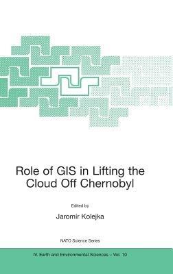
Role of GIS in Lifting the Cloud Off Chernobyl
(0)
Cliccando su “Conferma” dichiari che il contenuto da te inserito è conforme alle Condizioni Generali d’Uso del Sito ed alle Linee Guida sui Contenuti Vietati. Puoi rileggere e modificare e successivamente confermare il tuo contenuto. Tra poche ore lo troverai online (in caso contrario verifica la conformità del contenuto alle policy del Sito).
Grazie per la tua recensione!
Tra poche ore la vedrai online (in caso contrario verifica la conformità del testo alle nostre linee guida). Dopo la pubblicazione per te +4 punti 
132,70 €
+1330
punti 
Venditore: IBS
Articolo acquistabile con Carta del Docente

Articolo acquistabile con Carta Cultura Giovani e Carta del Merito

Articolo acquistabile con Carta della Cultura

Paga con Klarna in 3 rate senza interessi per ordini superiori a 39 €

Dati e Statistiche
 Salvato in 0 liste dei desideri
Salvato in 0 liste dei desideri
Role of GIS in Lifting the Cloud Off Chernobyl
Disponibilità in 2 settimane
132,70 €
132,70 €
Disponibilità in 2 settimane
Altre offerte vendute e spedite dai nostri venditori
Libri in Inglese
Role of GIS in Lifting the Cloud Off Chernobyl
Altri venditori
Prezzo e spese di spedizione
LIBRO INGLESE
Disponibilità in 2 settimane

Venduto e spedito da
IBS
Spedizione Gratis
132,70 €
Altri venditori
Prezzo e spese di spedizione
LIBRO INGLESE
Disponibilità in 2 settimane
Venduto e spedito da
IBS
Spedizione Gratis
132,70 €
Altri venditori
Prezzo e spese di spedizione

Tutti i formati ed edizioni
Promo attive (0)
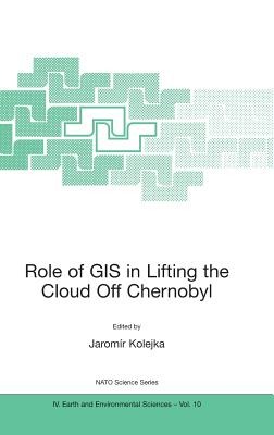
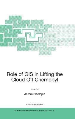
The 15th anniversary of the Chernobyl nuclear power plant disaster offered a timely opportunity for an expert assessment of the current situation and suggestions for approaches to managing the information associated with the site and surrounding contaminated territories. The great quantity of data coming from the contaminated region was and is very difficult to use without he aid of modern information technologies, especially Geographic Information Systems (GIS) and Remote Sensing (RS). Application of these technologies, and related expertise, became crucial to the region's economic recovery and sustainability planning. Given the real possibility of a similar accident at nuclear facilities elsewhere around the world, the development of recovery strategies based on experience gained at Chernobyl, using modern scientific methods and technologies, will be invaluable in the future. The presentations and discussion reported in the book have led to some key conclusions. Image maps derived from satellite imagery are the most economical, up to date and readily available basis for Chernobyl-related applications, as well as for other future applications. The study of soil-plant transfer of radionuclides afforded comparatively much more reliable data. GIS in association with adequate knowledge is a valuable tool in decision making and modelling of contaminated areas and objects.
Leggi di più
Leggi di meno
Curatore:
Editore:
Collana:
NATO Science Series: IV:
Anno:
2002
Rilegatura:
Hardback
Pagine:
160 p.
Testo in English
Dimensioni:
235 x 155 mm
EAN:
9781402007682

L'articolo è stato aggiunto al carrello
Informazioni e Contatti sulla Sicurezza dei Prodotti
Le schede prodotto sono aggiornate in conformità al Regolamento UE 988/2023. Laddove ci fossero taluni dati non disponibili per ragioni indipendenti da IBS, vi informiamo che stiamo compiendo ogni ragionevole sforzo per inserirli. Vi invitiamo a controllare periodicamente il sito www.ibs.it per eventuali novità e aggiornamenti.
Per le vendite di prodotti da terze parti, ciascun venditore si assume la piena e diretta responsabilità per la commercializzazione del prodotto e per la sua conformità al Regolamento UE 988/2023, nonché alle normative nazionali ed europee vigenti.
Per informazioni sulla sicurezza dei prodotti, contattare productsafetyibs@feltrinelli.it
L’articolo è stato aggiunto alla lista dei desideri
