L’articolo è stato aggiunto alla lista dei desideri

LIBRO INGLESE

 E-mail
 Facebook
 LinkedIn
 Twitter
 WhatsApp
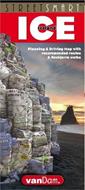
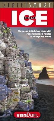
StreetSmart (R) Iceland Map by VanDam: laminated pocket-size, country planning and driving map
(0)
Cliccando su “Conferma” dichiari che il contenuto da te inserito è conforme alle Condizioni Generali d’Uso del Sito ed alle Linee Guida sui Contenuti Vietati. Puoi rileggere e modificare e successivamente confermare il tuo contenuto. Tra poche ore lo troverai online (in caso contrario verifica la conformità del contenuto alle policy del Sito).
Grazie per la tua recensione!
Tra poche ore la vedrai online (in caso contrario verifica la conformità del testo alle nostre linee guida). Dopo la pubblicazione per te +4 punti ![]()
15,38 €

-5%
16,19 €
+150
punti
Venditore: IBS
Articolo acquistabile con Carta del Docente

Articolo acquistabile con Carta Cultura Giovani e Carta del Merito

Articolo acquistabile con Carta della Cultura

Dati e Statistiche
 Salvato in 0 liste dei desideri
StreetSmart (R) Iceland Map by VanDam: laminated pocket-size, country planning and driving map
Disponibile in 5 gg lavorativi
15,38 €
-5%
16,19 €
15,38 €
16,19 €
-5%
Disponibile in 5 gg lavorativi
Altre offerte vendute e spedite dai nostri venditori
Libri in Inglese
StreetSmart (R) Iceland Map by VanDam: laminated pocket-size, country planning and driving map
Altri venditori
Prezzo e spese di spedizione

LIBRO INGLESE
Disponibile in 5 gg lavorativi

Venduto e spedito da
IBS
Spedizione Gratis
-5%
16,19 €
15,38 €
Altri venditori
Prezzo e spese di spedizione
LIBRO INGLESE
Disponibile in 5 gg lavorativi
Venduto e spedito da
IBS
Spedizione Gratis
-5%
16,19 €
15,38 €
Altri venditori
Prezzo e spese di spedizione
Tutti i formati ed edizioni
Promo attive (0)
VanDam's new StreetSmart (R) Iceland maps all of the island's cultural and natural treasures at an immensely legible scale complete with stunning 3D relief maps of the entire country. Clear information design has earned VanDam maps a place in the MoMA Collection. The map is laminated, pocket-size, durable, and easy-to-read and fold. Dimensions: 9 x 4 closed, 9 x 36 open.Coverage: Iceland country driving map: 1:1,900,000 Reykjavik city walking map: 1:23,000 StreetSmart (R) Iceland is so legible you can read it from three feet away and will instantly understand how the capital of Reykjavik connects with the Golden Circle, the South Coast with Vanjoekull National Park, and the Westman Islands with the Godafoss waterfall. You will know where to bird on the Reykanes Peninsula, hike in thorsmoerk Valley, whale watch at the Arctic Circle and where to break for lunch on Ring Road Drive through the East Fjords. This map is your visual guide and essential reference to the geothermal baths, geysers, glaciers, ice caves, fissures, volcanoes and the 4WD driving routes Iceland is famous for. StreetSmart (R) Iceland is designed to be both a planning tool and a durable road guide. The map gives you an overview to easily choose between the 6-day Ring Road trip spanning 800 miles, and three 10-12 hour day trips from Reykjavik to the Golden Circle, the South Coast, and West Iceland. Tested Route Guides describe highlights of each drive by day and hour and provide the necessary logistics to make sure you catch the 20:45 ferry into the sunset for an overnight stay on the Westman Islands. StreetSmart (R) Iceland map is waterproof, pocket-size and folds easily so you do not run the risk of covering the driver's sight lines when turning it over plus you avoid searching in vain for your missing wifi and roaming signals. So whether you want to cave dive at thingvellir National Park or simply marvel at the Mid-Ocean Ridge breaking the earth's surface to reveal how the Eurasian and North American plates push apart at Almannagja fissure, the geologic wonder that is Iceland - volcanoes covered by glaciers spilling into lagoons surrounded by black sand beaches lining the Arctic Ocean guarded by thousands of puffins - Iceland comes alive on this map. For a simple cultural overnight visit the map shows recommended walks, restaurants and shops in Downtown Reykjavik. If you are looking for The Phallus Museum, a dance performance at Idno Cultural House or you just want to find the restaurant serving the best local lamb we will get you there with confidence and ease. Hint: Apotek. Naming names: The map names all features in English so you can instantly tell that Solheimajoekull is a glacier, Gullfoss a waterfall and Hella a volcano. Clearly legible icons show where to bird, cave dive, swim, hike, sauna and whale watch around Iceland. StreetSmart (R) Iceland makes it all clear and understandable. For instance, you are on the scenic route 435 to thingvellir National Park via the Mosfellsheidi Valley when suddenly white steam rises from geothermal pipes embedded in black volcanic rocks covered with thick emerald moss carpets: An otherworldly sight. This map will give you the shortest and most scenic route to get there and back with confidence. Even though you may have a tour lined up and only need to follow the person in front of you this map will give you an insight into the unparalleled geologic, tectonic and volcanic riches that are Iceland. StreetSmart (R) Iceland makes it easy and you an instant Icelander.
Leggi di più
Leggi di meno
Pagine:
2 p.
Testo in English
Dimensioni:
225 x 100 mm
EAN:
9781934395905
L'articolo è stato aggiunto al carrello
Informazioni e Contatti sulla Sicurezza dei Prodotti
Le schede prodotto sono aggiornate in conformità al Regolamento UE 988/2023. Laddove ci fossero taluni dati non disponibili per ragioni indipendenti da IBS, vi informiamo che stiamo compiendo ogni ragionevole sforzo per inserirli. Vi invitiamo a controllare periodicamente il sito www.ibs.it per eventuali novità e aggiornamenti.
Per le vendite di prodotti da terze parti, ciascun venditore si assume la piena e diretta responsabilità per la commercializzazione del prodotto e per la sua conformità al Regolamento UE 988/2023, nonché alle normative nazionali ed europee vigenti.
Per informazioni sulla sicurezza dei prodotti, contattare productsafetyibs@feltrinelli.it
L’articolo è stato aggiunto alla lista dei desideri