L’articolo è stato aggiunto alla lista dei desideri
LIBRO INGLESE

 E-mail
 Facebook
 LinkedIn
 Twitter
 WhatsApp
Thames Path: With Ordnance Survey Mapping
(0)
Cliccando su “Conferma” dichiari che il contenuto da te inserito è conforme alle Condizioni Generali d’Uso del Sito ed alle Linee Guida sui Contenuti Vietati. Puoi rileggere e modificare e successivamente confermare il tuo contenuto. Tra poche ore lo troverai online (in caso contrario verifica la conformità del contenuto alle policy del Sito).
Grazie per la tua recensione!
Tra poche ore la vedrai online (in caso contrario verifica la conformità del testo alle nostre linee guida). Dopo la pubblicazione per te +4 punti ![]()
14,24 €

-5%
14,99 €
+140
punti
Venditore: IBS
Articolo acquistabile con Carta del Docente

Articolo acquistabile con Carta Cultura Giovani e Carta del Merito

Articolo acquistabile con Carta della Cultura

Dati e Statistiche
 Salvato in 0 liste dei desideri
Thames Path: With Ordnance Survey Mapping
Disponibile in 5 gg lavorativi
14,24 €
-5%
14,99 €
14,24 €
14,99 €
-5%
Disponibile in 5 gg lavorativi
Altre offerte vendute e spedite dai nostri venditori

Libri in Inglese
Thames Path: With Ordnance Survey Mapping
Altri venditori
Prezzo e spese di spedizione

Nuovo
Disponibile in 5 gg lavorativi

Venduto e spedito da
IBS
Spedizione Gratis
-5%
14,99 €
14,24 €
Altri venditori
Prezzo e spese di spedizione
Nuovo
Disponibile in 5 gg lavorativi
Venduto e spedito da
IBS
Spedizione Gratis
-5%
14,99 €
14,24 €
Altri venditori
Prezzo e spese di spedizione
Tutti i formati ed edizioni

Promo attive (0)
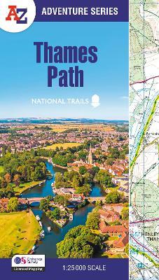
The A-Z Adventure series features the accuracy and quality of Ordnance Survey's 1:25000 mapping in a convenient book, therefore eliminating the need to fold and re-fold a large sheet map to the desired area. OS 1:25 000 is Ordnance Survey's most detailed mapping, showing public rights of way, open access land, national parks, tourist information, car parks, public houses and camping and caravan sites. The Thames Path is a National Trail which covers 298km (185 miles) and follows the length of Englands longest river, the Thames, from its source in the Cotswolds to the Thames Barrier in Greenwich, London. This A-Z Adventure Atlas of the Thames Path features 61 pages of continuous Ordnance Survey mapping providing complete coverage of the Thames Path. Clearly highlighted in yellow, the route is easy to identify and shows both north and south bank alternatives. In addition mileage markers have been introduced to the map making it easy to gauge distances when planning your own sections of the walk to enjoy. A route planner is also included providing distances between places and the amenities available, featuring: Information Centres Hotels/B&Bs Youth Hostels Campsites (seasonal opening) Pubs, shops, restaurants, and cafes (seasonal opening) Petrol Stations Also featured is advice on safety and security when walking and details of Tourist Information Centres. This A-Z Adventure Atlas has the accuracy and quality of OS 1:25000 mapping indexed within a book, making it the perfect companion for walkers, off-road cyclists, horse riders and anyone wishing to explore the great outdoors. Other National Trails available within the A-Z Adventure series: Coast to Coast, Cotswold Way, Pembrokeshire Coast Path, South Downs Way, and SW Coast Path.
Leggi di più
Leggi di meno
Autore:
Editore:
Collana:
A -Z Adventure Series
Anno:
2026
Rilegatura:
Paperback / softback
Pagine:
80 p.
Testo in English
Dimensioni:
240 x 134 mm
Peso:
130 gr.
EAN:
9780008780524
L'articolo è stato aggiunto al carrello
Informazioni e Contatti sulla Sicurezza dei Prodotti
Le schede prodotto sono aggiornate in conformità al Regolamento UE 988/2023. Laddove ci fossero taluni dati non disponibili per ragioni indipendenti da IBS, vi informiamo che stiamo compiendo ogni ragionevole sforzo per inserirli. Vi invitiamo a controllare periodicamente il sito www.ibs.it per eventuali novità e aggiornamenti.
Per le vendite di prodotti da terze parti, ciascun venditore si assume la piena e diretta responsabilità per la commercializzazione del prodotto e per la sua conformità al Regolamento UE 988/2023, nonché alle normative nazionali ed europee vigenti.
Per informazioni sulla sicurezza dei prodotti, contattare productsafetyibs@feltrinelli.it
L’articolo è stato aggiunto alla lista dei desideri