L’articolo è stato aggiunto alla lista dei desideri
LIBRO INGLESE

 E-mail
 Facebook
 LinkedIn
 Twitter
 WhatsApp
The Ultimate UK Cycle Route Planner Map: 20,000 plus miles of leisure routes
(0)
Cliccando su “Conferma” dichiari che il contenuto da te inserito è conforme alle Condizioni Generali d’Uso del Sito ed alle Linee Guida sui Contenuti Vietati. Puoi rileggere e modificare e successivamente confermare il tuo contenuto. Tra poche ore lo troverai online (in caso contrario verifica la conformità del contenuto alle policy del Sito).
Grazie per la tua recensione!
Tra poche ore la vedrai online (in caso contrario verifica la conformità del testo alle nostre linee guida). Dopo la pubblicazione per te +4 punti ![]()
11,82 €

-5%
12,44 €
+120
punti
Venditore: IBS
Articolo acquistabile con Carta del Docente

Articolo acquistabile con Carta Cultura Giovani e Carta del Merito

Articolo acquistabile con Carta della Cultura

Dati e Statistiche
 Salvato in 0 liste dei desideri
The Ultimate UK Cycle Route Planner Map: 20,000 plus miles of leisure routes
Disponibile in 5 gg lavorativi
11,82 €
-5%
12,44 €
11,82 €
12,44 €
-5%
Disponibile in 5 gg lavorativi
Altre offerte vendute e spedite dai nostri venditori

Libri in Inglese
The Ultimate UK Cycle Route Planner Map: 20,000 plus miles of leisure routes
Altri venditori
Prezzo e spese di spedizione

Nuovo
Disponibile in 5 gg lavorativi

Venduto e spedito da
IBS
Spedizione Gratis
-5%
12,44 €
11,82 €
Altri venditori
Prezzo e spese di spedizione
Nuovo
Disponibile in 5 gg lavorativi
Venduto e spedito da
IBS
Spedizione Gratis
-5%
12,44 €
11,82 €
Altri venditori
Prezzo e spese di spedizione
Tutti i formati ed edizioni

Promo attive (0)
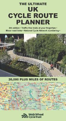
Fully updated and revised 5th edition for 2025. Published by Richard Peace Cycling in collaboration with Walk Wheel Cycle Trust (formerly Sustrans). One of the best selling UK cycle publications, giving an overview of all the main signed UK cycle routes (and also major unsigned ones) - the only publication that has all these together on one single map. Clear design means it is easy to identify the many different kinds of cycle route, from canal towpaths to newer bikepacking and long-distance off-road trails such as the Wolf Way and the Marcher Castles Way. National Cycle Network route numbers are clearly shown, corresponding with route signage on the ground. Other routes include regional routes such as county cycle ways and those National Trails on which bikes are allowed such as the Pennine Bridleway and the Ridgeway. Many hundreds of miles of minor road routes are also shown and links to signed cross-channel routes such as the Avenue Verte (London-Paris) are shown so that long distance route planning is also made easy. A bespoke key makes the map easy to understand at a glance. The UK's rail network and its myriad of stations is detailed, showing where and how cyclists can combine bike and train to get access to the country's best cycling. As the scale of the map makes it suitable for planning rather than navigation, full details are given of where you can get larger scale maps of popular rides, such as the C2C, the Devon Coast to Coast and the Way of the Roses.
Leggi di più
Leggi di meno
Autore:
Editore:
Anno:
2025
Rilegatura:
Sheet map, folded
Pagine:
2 p.
Testo in English
Dimensioni:
240 x 133 mm
EAN:
9781901464436
L'articolo è stato aggiunto al carrello
Informazioni e Contatti sulla Sicurezza dei Prodotti
Le schede prodotto sono aggiornate in conformità al Regolamento UE 988/2023. Laddove ci fossero taluni dati non disponibili per ragioni indipendenti da IBS, vi informiamo che stiamo compiendo ogni ragionevole sforzo per inserirli. Vi invitiamo a controllare periodicamente il sito www.ibs.it per eventuali novità e aggiornamenti.
Per le vendite di prodotti da terze parti, ciascun venditore si assume la piena e diretta responsabilità per la commercializzazione del prodotto e per la sua conformità al Regolamento UE 988/2023, nonché alle normative nazionali ed europee vigenti.
Per informazioni sulla sicurezza dei prodotti, contattare productsafetyibs@feltrinelli.it
L’articolo è stato aggiunto alla lista dei desideri