

L’articolo è stato aggiunto alla lista dei desideri








LIBRO INGLESE
 E-mail
 Facebook
 LinkedIn
 Twitter
 WhatsApp
Geospatial Technologies for Land Degradation Assessment and Management
(0)
Cliccando su “Conferma” dichiari che il contenuto da te inserito è conforme alle Condizioni Generali d’Uso del Sito ed alle Linee Guida sui Contenuti Vietati. Puoi rileggere e modificare e successivamente confermare il tuo contenuto. Tra poche ore lo troverai online (in caso contrario verifica la conformità del contenuto alle policy del Sito).
Grazie per la tua recensione!
Tra poche ore la vedrai online (in caso contrario verifica la conformità del testo alle nostre linee guida). Dopo la pubblicazione per te +4 punti 

84,70 €
+850
punti 
Venditore: IBS
Articolo acquistabile con Carta del Docente

Articolo acquistabile con Carta Cultura Giovani e Carta del Merito

Articolo acquistabile con Carta della Cultura

Paga con Klarna in 3 rate senza interessi per ordini superiori a 39 €

Dati e Statistiche
 Salvato in 0 liste dei desideri
Salvato in 0 liste dei desideri
Geospatial Technologies for Land Degradation Assessment and Management
Disponibilità in 2 settimane
84,70 €
84,70 €
Disponibilità in 2 settimane
Altre offerte vendute e spedite dai nostri venditori
Libri in Inglese
Geospatial Technologies for Land Degradation Assessment and Management
Altri venditori
Prezzo e spese di spedizione
LIBRO INGLESE
Disponibilità in 2 settimane

Venduto e spedito da
IBS
Spedizione Gratis
84,70 €
Altri venditori
Prezzo e spese di spedizione
LIBRO INGLESE
Disponibilità in 2 settimane
Venduto e spedito da
IBS
Spedizione Gratis
84,70 €
Altri venditori
Prezzo e spese di spedizione

Tutti i formati ed edizioni
Promo attive (1)
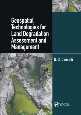
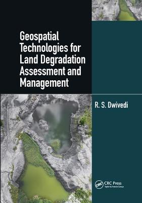
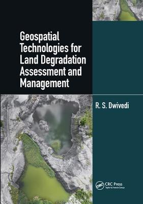
The constant growth of the world’s population and the decline of the availability of land and soil resources are global concerns for food security. Other concerns are the decrease in productivity and delivery of essential ecosystems services because of the decline of soil quality and health by a range of degradation processes. Key soil properties like soil bulk density, organic carbon concentration, plant available water capacity, infiltration rate, air porosity at field moisture capacity, and nutrient reserves, are crucial properties for soil functionality which refers to the capacity of soil to perform numerous functions. These functions are difficult to measure directly and are estimated through indices of soil quality and soil health. Soil degradation, its extent and severity, can also be estimated by assessing indices of soil quality and health. "Geospatial Technology for Land Degradation Assessment and Management" uses satellite imagery and remote sensing technologies to measure landscape parameters and terrain attributes. Remote sensing and geospatial technologies are important tools in assessing the extent and the severity of land and soil degradation, their temporal changes, and geospatial distribution in a timely and cost-effective manner. The knowledge presented in the book by Dr. R.S. Dwivedi shows how remote sensing data can be utilized for inventorying, assessing, and monitoring affected ecosystems and how this information can be integrated in the models of different local settings. Through many land degradations studies, land managers, researchers, and policymakers will find practical applications of geospatial technologies and future challenges. The information presented is also relevant to advancing the Sustainable Development Goals of the United Nations towards global food security.
Leggi di più
Leggi di meno
Autore:
Editore:
Anno:
2020
Rilegatura:
Paperback / softback
Pagine:
416 p.
Testo in English
Dimensioni:
254 x 178 mm
Peso:
811 gr.
EAN:
9780367570897

L'articolo è stato aggiunto al carrello
Informazioni e Contatti sulla Sicurezza dei Prodotti
Le schede prodotto sono aggiornate in conformità al Regolamento UE 988/2023. Laddove ci fossero taluni dati non disponibili per ragioni indipendenti da IBS, vi informiamo che stiamo compiendo ogni ragionevole sforzo per inserirli. Vi invitiamo a controllare periodicamente il sito www.ibs.it per eventuali novità e aggiornamenti.
Per le vendite di prodotti da terze parti, ciascun venditore si assume la piena e diretta responsabilità per la commercializzazione del prodotto e per la sua conformità al Regolamento UE 988/2023, nonché alle normative nazionali ed europee vigenti.
Per informazioni sulla sicurezza dei prodotti, contattare productsafetyibs@feltrinelli.it
L’articolo è stato aggiunto alla lista dei desideri
