

L’articolo è stato aggiunto alla lista dei desideri









LIBRO INGLESE
 E-mail
 Facebook
 LinkedIn
 Twitter
 WhatsApp
Thematic Cartography and Geovisualization
(0)
Cliccando su “Conferma” dichiari che il contenuto da te inserito è conforme alle Condizioni Generali d’Uso del Sito ed alle Linee Guida sui Contenuti Vietati. Puoi rileggere e modificare e successivamente confermare il tuo contenuto. Tra poche ore lo troverai online (in caso contrario verifica la conformità del contenuto alle policy del Sito).
Grazie per la tua recensione!
Tra poche ore la vedrai online (in caso contrario verifica la conformità del testo alle nostre linee guida). Dopo la pubblicazione per te +4 punti 

148,43 €

-5%
156,24 €
+1480
punti
Venditore: IBS
Articolo acquistabile con Carta del Docente

Articolo acquistabile con Carta Cultura Giovani e Carta del Merito

Articolo acquistabile con Carta della Cultura

Paga con Klarna in 3 rate senza interessi per ordini superiori a 39 €

Dati e Statistiche
 Salvato in 0 liste dei desideri
Salvato in 0 liste dei desideri
Thematic Cartography and Geovisualization
Disponibile in 5 gg lavorativi
148,43 €
-5%
156,24 €
148,43 €
156,24 €
-5%
Disponibile in 5 gg lavorativi
Altre offerte vendute e spedite dai nostri venditori

Libri in Inglese
Thematic Cartography and Geovisualization
Altri venditori
Prezzo e spese di spedizione
LIBRO INGLESE
Disponibile in 5 gg lavorativi

Venduto e spedito da
IBS
Spedizione Gratis
-5%
156,24 €
148,43 €
Altri venditori
Prezzo e spese di spedizione
LIBRO INGLESE
Disponibile in 5 gg lavorativi
Venduto e spedito da
IBS
Spedizione Gratis
-5%
156,24 €
148,43 €
Altri venditori
Prezzo e spese di spedizione

Tutti i formati ed edizioni

Promo attive (1)
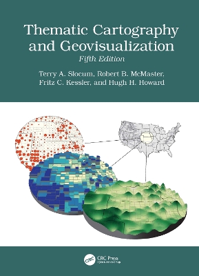
The fifth edition of this comprehensive and well-established book in cartography has been thoroughly updated and extensively restructured to incorporate new developments in recent years. It reflects advancements in technology, societal changes, and evolving methodologies in the field of cartography. With the inclusion of entirely new chapters, restructured content, and expanded discussions, the book provides a modern perspective on cartographic practices. It emphasizes the integration of Artificial Intelligence, the democratization of mapping through web-based tools, and innovative approaches to visualizing spatiotemporal data. Additionally, it addresses historical paradigms, geovisual analytics, and the adaptation of map elements and typography for mobile and web platforms, ensuring relevance in today's digital age. Some Key Features of the Fifth Edition Artificial Intelligence in Cartography: A new chapter explores AI's 75-year history, deep learning, cartographic applications, and ethical implications. Maps, Mapping, and Society: A new chapter highlights the democratization of map-making through web-based tools, empowering the general public. History of Thematic Mapping: Restructured to cover American cartographic paradigms, including analytical, design and production, education, statistical mapping, and symbolization. Visualizing Spatiotemporal Data: Formerly "Animation," this chapter now includes alternatives such as change maps, small multiples, and space-time cubes. Geovisual Analytics: Expanded to include the Australian Cancer Atlas and dashboard development. Map Elements and Typography: Expanded to include guidelines for mobile devices and web browsers. Elements of Map Projections: Now discusses the Universal Transverse Mercator (UTM) and State Plane Coordinate System (SPCS) grid systems.
Leggi di più
Leggi di meno
Editore:
Anno:
2026
Rilegatura:
Hardback
Pagine:
616 p.
Testo in English
Dimensioni:
280 x 210 mm
EAN:
9781041033752

L'articolo è stato aggiunto al carrello
Informazioni e Contatti sulla Sicurezza dei Prodotti
Le schede prodotto sono aggiornate in conformità al Regolamento UE 988/2023. Laddove ci fossero taluni dati non disponibili per ragioni indipendenti da IBS, vi informiamo che stiamo compiendo ogni ragionevole sforzo per inserirli. Vi invitiamo a controllare periodicamente il sito www.ibs.it per eventuali novità e aggiornamenti.
Per le vendite di prodotti da terze parti, ciascun venditore si assume la piena e diretta responsabilità per la commercializzazione del prodotto e per la sua conformità al Regolamento UE 988/2023, nonché alle normative nazionali ed europee vigenti.
Per informazioni sulla sicurezza dei prodotti, contattare productsafetyibs@feltrinelli.it
L’articolo è stato aggiunto alla lista dei desideri
