L’articolo è stato aggiunto alla lista dei desideri

LIBRO INGLESE

 E-mail
 Facebook
 LinkedIn
 Twitter
 WhatsApp
Topographical Map of the Lake District Wainwright Fells
(0)
Cliccando su “Conferma” dichiari che il contenuto da te inserito è conforme alle Condizioni Generali d’Uso del Sito ed alle Linee Guida sui Contenuti Vietati. Puoi rileggere e modificare e successivamente confermare il tuo contenuto. Tra poche ore lo troverai online (in caso contrario verifica la conformità del contenuto alle policy del Sito).
Grazie per la tua recensione!
Tra poche ore la vedrai online (in caso contrario verifica la conformità del testo alle nostre linee guida). Dopo la pubblicazione per te +4 punti ![]()
10,63 €

-5%
11,19 €
+110
punti
Venditore: IBS
Articolo acquistabile con Carta del Docente

Articolo acquistabile con Carta Cultura Giovani e Carta del Merito

Dati e Statistiche
 Salvato in 0 liste dei desideri
Topographical Map of the Lake District Wainwright Fells
Disponibile in 5 giorni lavorativi
10,63 €
-5%
11,19 €
10,63 €
11,19 €
-5%
Disp. in 5 gg lavorativi

Topographical Map of the Lake District Wainwright Fells
Libri in Inglese
Altri venditori
Prezzo e spese di spedizione

Venduto e spedito da IBS
10,63 €
Spedizione gratuita
Altri venditori
Prezzo e spese di spedizione
Venduto e spedito da IBS
10,63 €
Spedizione gratuita
Altri venditori
Prezzo e spese di spedizione
Tutti i formati ed edizioni
Promo attive (0)
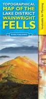
This map shows all of the 214 Wainwright Fells of the Lake District very clearly on a high quality topographical base map. It will especially appeal to those walkers who are aiming to climb all the Wainwright Fells and want a clear, user-friendly aid to plan their trips and to mark off the fells as they do them. The map has been carefully designed to show essential detail as clearly as possible, whilst leaving off the things of less relevance (including footpaths) that would otherwise clutter the map. The result is a map of the Lake District that is one of the clearest, most legible and elegant maps available today. The base map is a detailed topographical map (based on O.S. geodata) that shows - towns, villages, roads, railways, stations, ferry crossings, youth hostels, campsites, rivers, lakes and mountains. Topographical relief is shown by graduated colour layers with a 50m contour interval. Each Wainwright summit is clearly labeled with the fell name together with a small circle so that you can mark off a peak when you have done it. Popular starting and parking places are shown with a small blue dot to further aid planning routes. Place and fell names are easily legible. The map is a convenient size so that it is easy to use - either opened out on a table, in the car, or when displayed on the wall. The map is printed on high quality paper. On the reverse of the map are tables and lists of the 214 Fells, with their heights with a wide column so the user can record the date climbed and personal notes. There is also helpful information on recommended books, web sites, etc. Rivers Publishing is a well established, specialist publisher based in the Lake District. Over the last twenty years they have built up a reputation for best-selling, quality guide books and maps.
Leggi di più
Leggi di meno
Testo in English
Dimensioni:
245 x 115 mm
EAN:
9780955061479
L'articolo è stato aggiunto al carrello
L’articolo è stato aggiunto alla lista dei desideri