

L’articolo è stato aggiunto alla lista dei desideri









LIBRO INGLESE
 E-mail
 Facebook
 LinkedIn
 Twitter
 WhatsApp
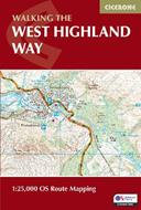
West Highland Way Map Booklet: 1:25,000 OS Route Mapping
(0)
Cliccando su “Conferma” dichiari che il contenuto da te inserito è conforme alle Condizioni Generali d’Uso del Sito ed alle Linee Guida sui Contenuti Vietati. Puoi rileggere e modificare e successivamente confermare il tuo contenuto. Tra poche ore lo troverai online (in caso contrario verifica la conformità del contenuto alle policy del Sito).
Grazie per la tua recensione!
Tra poche ore la vedrai online (in caso contrario verifica la conformità del testo alle nostre linee guida). Dopo la pubblicazione per te +4 punti 

11,82 €

-5%
12,44 €
+120
punti
Venditore: IBS
Articolo acquistabile con Carta del Docente

Articolo acquistabile con Carta Cultura Giovani e Carta del Merito

Articolo acquistabile con Carta della Cultura

Dati e Statistiche
 Salvato in 0 liste dei desideri
Salvato in 0 liste dei desideri
West Highland Way Map Booklet: 1:25,000 OS Route Mapping
Non disponibile, ma lo cercheremo per te!
11,82 €
-5%
12,44 €
11,82 €
12,44 €
-5%
Non disponibile, ma lo cercheremo per te!
Altre offerte vendute e spedite dai nostri venditori
Libri in Inglese
West Highland Way Map Booklet: 1:25,000 OS Route Mapping
Altri venditori
Prezzo e spese di spedizione

LIBRO INGLESE
Non disponibile,
ma lo cercheremo per te!

Venduto e spedito da
IBS
Spedizione Gratis
-5%
12,44 €
11,82 €
Altri venditori
Prezzo e spese di spedizione
LIBRO INGLESE
Non disponibile,
ma lo cercheremo per te!
Venduto e spedito da
IBS
Spedizione Gratis
-5%
12,44 €
11,82 €
Altri venditori
Prezzo e spese di spedizione

Tutti i formati ed edizioni

Stretching 155km (97 miles) across Scotland from Milngavie to Fort William, the West Highland Way is one of Scotland's Great Trails and one of the most celebrated long-distance walks in the British Isles. Passing through the stunning landscapes of Loch Lomond, Rannoch Moor and Glencoe, it is suitable for walkers of most abilities and typically completed in around a week. The West Highland Way Map Booklet is a compact, lightweight walking map and navigation companion featuring the entire route on detailed OS mapping. Designed for use on the move, it provides clear, reliable mapping in a convenient pocket-sized format. Full West Highland Way route shown on Ordnance Survey 1:25,000 mapping for precise navigation whilst walking from Milngavie to Fort William Clearly marked trail line through Loch Lomond and The Trossachs National Park and across the open moorland of Rannoch Moor, past Buachaille Etive Mor and through Glencoe, with key highlights including the Devil's Staircase and Lairig Mor Continuous mapping format in a compact, pocket-sized booklet, eliminating the need for multiple separate map sheets The booklet can be used in either direction, with the relevant OS Explorer map legend included for easy reference For step-by-step route descriptions and planning advice, the accompanying Cicerone guidebook, Walking the West Highland Way, is also available and includes a copy of this map booklet Compact enough to slip into a jacket pocket and clear enough to use on the move, the West Highland Way Map Booklet is the essential navigation companion for one of Scotland's greatest walks.
Leggi di più
Leggi di meno
Autore:
Editore:
Anno:
2026
Rilegatura:
Paperback / softback
Pagine:
56 p.
Testo in English
Dimensioni:
166 x 106 mm
Peso:
60 gr.
EAN:
9781786311788

L'articolo è stato aggiunto al carrello
Informazioni e Contatti sulla Sicurezza dei Prodotti
Le schede prodotto sono aggiornate in conformità al Regolamento UE 988/2023. Laddove ci fossero taluni dati non disponibili per ragioni indipendenti da IBS, vi informiamo che stiamo compiendo ogni ragionevole sforzo per inserirli. Vi invitiamo a controllare periodicamente il sito www.ibs.it per eventuali novità e aggiornamenti.
Per le vendite di prodotti da terze parti, ciascun venditore si assume la piena e diretta responsabilità per la commercializzazione del prodotto e per la sua conformità al Regolamento UE 988/2023, nonché alle normative nazionali ed europee vigenti.
Per informazioni sulla sicurezza dei prodotti, contattare productsafetyibs@feltrinelli.it
L’articolo è stato aggiunto alla lista dei desideri
