L’articolo è stato aggiunto alla lista dei desideri

LIBRO INGLESE

 E-mail
 Facebook
 LinkedIn
 Twitter
 WhatsApp
World War I Illustrated Atlas
(0)
Cliccando su “Conferma” dichiari che il contenuto da te inserito è conforme alle Condizioni Generali d’Uso del Sito ed alle Linee Guida sui Contenuti Vietati. Puoi rileggere e modificare e successivamente confermare il tuo contenuto. Tra poche ore lo troverai online (in caso contrario verifica la conformità del contenuto alle policy del Sito).
Grazie per la tua recensione!
Tra poche ore la vedrai online (in caso contrario verifica la conformità del testo alle nostre linee guida). Dopo la pubblicazione per te +4 punti ![]()
27,30 €

-5%
28,74 €
+270
punti
Venditore: IBS
Articolo acquistabile con Carta del Docente

Articolo acquistabile con Carta Cultura Giovani e Carta del Merito

Dati e Statistiche
 Salvato in 0 liste dei desideri
World War I Illustrated Atlas
Disponibilità in 5 giorni lavorativi
27,30 €
-5%
28,74 €
27,30 €
28,74 €
-5%
Disp. in 5 gg lavorativi
Altre offerte vendute e spedite dai nostri venditori
Libri in Inglese
World War I Illustrated Atlas
Altri venditori
Prezzo e spese di spedizione

Nuovo
 disponibilità in 5 giorni lavorativi
 Venduto e spedito da
IBS
Venduto e spedito da
IBS
Spedizione Gratis
-5%
28,74 €
27,30 €
Altri venditori
Prezzo e spese di spedizione
Nuovo
disponibilità in 5 giorni lavorativi
Venduto e spedito da
IBS
Spedizione Gratis
-5%
28,74 €
27,30 €
Altri venditori
Prezzo e spese di spedizione
Tutti i formati ed edizioni
Promo attive (0)
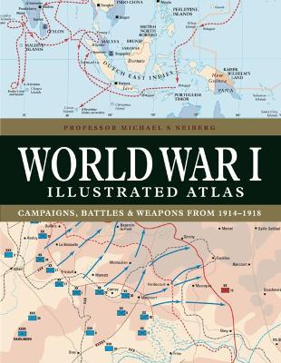
World War I might conjure up images of the trenches of the Western Front where the fighting raged for nearly four and half years, but this was only part of what was truly a world war. It was a complex conflict fought in a number of theatres: an air war, a land war fought in the Balkans, Italy, Africa, Turkey and the Middle East, and also a naval war fought in the North Sea, South Atlantic, South Pacific and Indian Oceans. The ‘Great War’ introduced killing on an unprecedented scale and resulted in the loss of millions of lives. World War I Illustrated Atlas is a comprehensive visual guide to this complex conflict. In fine detail, it plots the exact course of the land, sea and air campaigns, enabling the reader to trace the ebb and flow of the fortunes of all sides. With more than 180 full-colour maps, every theatre of war is covered – from the Western Front to Penang, from Gallipoli to Galicia, from Dogger Bank to Dalmatia, from Romania to Rhodesia and from the Falklands to Togo and the Sinai desert. All the maps have been specially commissioned from an expert cartographer. Each map is designed to highlight a particular aspect of the war – thus maps vary in shape and size, with some giving a global perspective while others depict the exact movement of armed forces on land, sea or in the air. Battles such as Jutland, the Somme, Cambrai and the Gallipoli campaign are shown in great detail. All maps are accompanied by an explanatory key. With expert, accessible text and accompanying archival photographs, this complete atlas provides an invaluable work of reference for both the general reader and the serious student of World War I.
Leggi di più
Leggi di meno
Autore:
Editore:
Collana:
Atlas
Anno:
2023
Rilegatura:
Hardback
Pagine:
192 p.
Testo in English
Dimensioni:
270 x 208 mm
Peso:
950 gr.
EAN:
9781838863548
L'articolo è stato aggiunto al carrello
Informazioni e Contatti sulla Sicurezza dei Prodotti
Le schede prodotto sono aggiornate in conformità al Regolamento UE 988/2023. Laddove ci fossero taluni dati non disponibili per ragioni indipendenti da IBS, vi informiamo che stiamo compiendo ogni ragionevole sforzo per inserirli. Vi invitiamo a controllare periodicamente il sito www.ibs.it per eventuali novità e aggiornamenti.
Per le vendite di prodotti da terze parti, ciascun venditore si assume la piena e diretta responsabilità per la commercializzazione del prodotto e per la sua conformità al Regolamento UE 988/2023, nonché alle normative nazionali ed europee vigenti.
Per informazioni sulla sicurezza dei prodotti, contattare productsafetyibs@feltrinelli.it
L’articolo è stato aggiunto alla lista dei desideri