

L’articolo è stato aggiunto alla lista dei desideri








LIBRO INGLESE
 E-mail
 Facebook
 LinkedIn
 Twitter
 WhatsApp
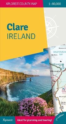
The Xploreit Map of County Clare Ireland
(0)
Cliccando su “Conferma” dichiari che il contenuto da te inserito è conforme alle Condizioni Generali d’Uso del Sito ed alle Linee Guida sui Contenuti Vietati. Puoi rileggere e modificare e successivamente confermare il tuo contenuto. Tra poche ore lo troverai online (in caso contrario verifica la conformità del contenuto alle policy del Sito).
Grazie per la tua recensione!
Tra poche ore la vedrai online (in caso contrario verifica la conformità del testo alle nostre linee guida). Dopo la pubblicazione per te +4 punti 
20,18 €

-5%
21,24 €
+200
punti
Venditore: IBS
Articolo acquistabile con Carta del Docente

Articolo acquistabile con Carta Cultura Giovani e Carta del Merito

Articolo acquistabile con Carta della Cultura

Dati e Statistiche
 Salvato in 0 liste dei desideri
Salvato in 0 liste dei desideri
The Xploreit Map of County Clare Ireland
Disponibile in 5 gg lavorativi
20,18 €
-5%
21,24 €
20,18 €
21,24 €
-5%
Disponibile in 5 gg lavorativi
Altre offerte vendute e spedite dai nostri venditori
Libri in Inglese
The Xploreit Map of County Clare Ireland
Altri venditori
Prezzo e spese di spedizione
LIBRO INGLESE
Disponibile in 5 gg lavorativi

Venduto e spedito da
IBS
Spedizione Gratis
-5%
21,24 €
20,18 €
Altri venditori
Prezzo e spese di spedizione
LIBRO INGLESE
Disponibile in 5 gg lavorativi
Venduto e spedito da
IBS
Spedizione Gratis
-5%
21,24 €
20,18 €
Altri venditori
Prezzo e spese di spedizione

Tutti i formati ed edizioni
Promo attive (0)
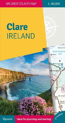
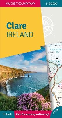
This Xploreit map is an essential companion for your next trip to County Clare. Whatever your location in the county, a quick scan of the map will reveal all the local attractions including the best drives, cycle routes and walks in the area. It is fully revised and now includes the Clare section of the long-distance Euro Velo Atlantic Cycle Route. From Loop Head, with its famous lighthouse, you can follow West Clare's wild and rugged coast as it rises to the spectacular Cliffs of Moher and meets The Burren, the unique limestone pavement of the northern uplands. East Clare has numerous walking and sightseeing opportunities also, with Lough Derg and Slieve Bernagh as highlights. Convenient and informative, this touring map will help you discover ancient megalithic tombs, imposing castles, sparkling lakes, golden beaches and the many charming towns and villages dotted around 'The Banner County'. Topography is shown by altitude colouring with contours at 30m and numerous geographical features are illustrated. The road network includes local roads and tracks with scenic roads highlighted including the Clare section of the Wild Atlantic Way and its Discovery Points. The map is double-sided for easy reading and folding. It is light and fits conveniently in a glovebox or rucksack. A wide range of symbols indicate various places of interest: antiquities, leisure facilities, museums and heritage sites, tourist information centres, campsites and caravan parks, etc. Place names are indexed and latitude and longitude lines are shown in decimal degrees at intervals of 0.01 and 0.1 respectively making it easy to estimate coordinates for GPS devices. A useful street map of Ennis is also provided. * All of County Clare on one touring map * Easy to read, clear mapping * Local drives, cycle routes and walks * Large range of tourist attractions highlighted * Place name index * Handy street map of Ennis * Lightweight, easy to fold and carry
Leggi di più
Leggi di meno
Autore:
Anno:
2024
Rilegatura:
Sheet map
Pagine:
2 p.
Testo in English
Dimensioni:
246 x 131 mm
Peso:
101 gr.
EAN:
9781738413607

L'articolo è stato aggiunto al carrello
Informazioni e Contatti sulla Sicurezza dei Prodotti
Le schede prodotto sono aggiornate in conformità al Regolamento UE 988/2023. Laddove ci fossero taluni dati non disponibili per ragioni indipendenti da IBS, vi informiamo che stiamo compiendo ogni ragionevole sforzo per inserirli. Vi invitiamo a controllare periodicamente il sito www.ibs.it per eventuali novità e aggiornamenti.
Per le vendite di prodotti da terze parti, ciascun venditore si assume la piena e diretta responsabilità per la commercializzazione del prodotto e per la sua conformità al Regolamento UE 988/2023, nonché alle normative nazionali ed europee vigenti.
Per informazioni sulla sicurezza dei prodotti, contattare productsafetyibs@feltrinelli.it
L’articolo è stato aggiunto alla lista dei desideri
