L’articolo è stato aggiunto alla lista dei desideri


LIBRO INGLESE

 E-mail
 Facebook
 LinkedIn
 Twitter
 WhatsApp
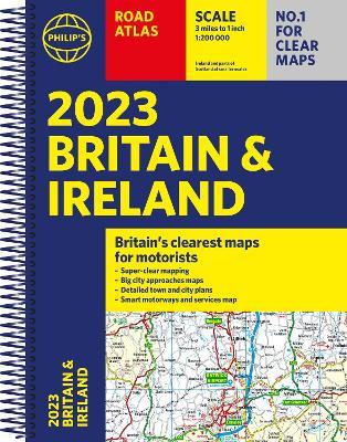
2023 Philip's Road Atlas Britain and Ireland: (A4 Spiral)
(0)
Cliccando su “Conferma” dichiari che il contenuto da te inserito è conforme alle Condizioni Generali d’Uso del Sito ed alle Linee Guida sui Contenuti Vietati. Puoi rileggere e modificare e successivamente confermare il tuo contenuto. Tra poche ore lo troverai online (in caso contrario verifica la conformità del contenuto alle policy del Sito).
Grazie per la tua recensione!
Tra poche ore la vedrai online (in caso contrario verifica la conformità del testo alle nostre linee guida). Dopo la pubblicazione per te +4 punti ![]()
18,99 €

-5%
19,99 €
+190
punti
Venditore: IBS
Articolo acquistabile con Bonus Cultura 18app e Carta del Docente


Articolo acquistabile con Carta Cultura Giovani e Carta del Merito

Dati e Statistiche
 Salvato in 0 liste dei desideri
2023 Philip's Road Atlas Britain and Ireland: (A4 Spiral)
Disponibile in 5 giorni lavorativi
18,99 €
-5%
19,99 €
18,99 €
19,99 €
-5%
Disp. in 5 gg lavorativi

2023 Philip's Road Atlas Britain and Ireland: (A4 Spiral)
Libri in Inglese
Altri venditori
Prezzo e spese di spedizione

Venduto e spedito da IBS
18,99 €
Spedizione gratuita
Altri venditori
Prezzo e spese di spedizione
Venduto e spedito da IBS
18,99 €
Spedizione gratuita
Altri venditori
Prezzo e spese di spedizione
Tutti i formati ed edizioni
Promo attive (0)
PHILIP'S - No. 1 in the UK for clear maps 'Good balance between detail and clarity with excellent town maps' What Car? * Mapping at a scale of 3 miles to 1 inch = 1:200,000 * Philip's: Market leader and Britain's clearest maps for motorists * Completely updated and revised for 2023 * New map showing Smart Motorways - Practical spiral bound, lie-flat format - 160 pages of fully updated super-clear road maps - 10 pages of detailed route-planning maps - plan your route in advance - 88 indexed town-centre maps - 14 pages of city approach maps with named arterial roads - 2 page road map of Ireland - Map of scenic Britain and a map highlighting railways, airports and ferry ports Philip's 2023 Road Atlas Britain and Ireland is the top-of-the-range spiral road atlas featuring the latest maps from the Philip's digital database. Voted Britain's clearest and most detailed in an independent consumer survey, the mapping is super-clear. Philip's 2023 Road Atlas Britain and Ireland contains 160 pages of road maps covering Britain at 3 miles to 1 inch, with the Western Isles, Orkney and Shetland at smaller scales. The maps clearly mark service areas, roundabouts and multi-level junctions, and in rural areas distinguish between roads over and under 4 metres wide. The atlas also includes a 2-page road map of Ireland, 10 pages of route-planning maps, a distance table, 10 large-scale city approach maps with named arterial roads, and 88 extra-detailed and fully indexed town and city plans.
Leggi di più
Leggi di meno
Autore:
Editore:
Collana:
Philip's Road Atlases
Anno:
2022
Rilegatura:
Spiral bound
Pagine:
256 p.
Testo in English
Dimensioni:
294 x 220 mm
Peso:
680 gr.
EAN:
9781849076098
L'articolo è stato aggiunto al carrello
L’articolo è stato aggiunto alla lista dei desideri