L’articolo è stato aggiunto alla lista dei desideri

LIBRO INGLESE

 E-mail
 Facebook
 LinkedIn
 Twitter
 WhatsApp
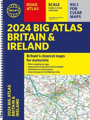
2024 Philip's Big Road Atlas Britain & Ireland: A3 Spiral binding
(0)
Cliccando su “Conferma” dichiari che il contenuto da te inserito è conforme alle Condizioni Generali d’Uso del Sito ed alle Linee Guida sui Contenuti Vietati. Puoi rileggere e modificare e successivamente confermare il tuo contenuto. Tra poche ore lo troverai online (in caso contrario verifica la conformità del contenuto alle policy del Sito).
Grazie per la tua recensione!
Tra poche ore la vedrai online (in caso contrario verifica la conformità del testo alle nostre linee guida). Dopo la pubblicazione per te +4 punti ![]()
18,99 €

-5%
19,99 €
+190
punti
Venditore: IBS
Articolo acquistabile con Carta del Docente

Articolo acquistabile con Carta Cultura Giovani e Carta del Merito

Articolo acquistabile con Carta della Cultura

Dati e Statistiche
 Salvato in 0 liste dei desideri
2024 Philip's Big Road Atlas Britain & Ireland: A3 Spiral binding
Disponibile in 5 gg lavorativi
18,99 €
-5%
19,99 €
18,99 €
19,99 €
-5%
Disponibile in 5 gg lavorativi
Altre offerte vendute e spedite dai nostri venditori

Libri in Inglese
2024 Philip's Big Road Atlas Britain & Ireland: A3 Spiral binding
Altri venditori
Prezzo e spese di spedizione

Nuovo
Disponibile in 5 gg lavorativi

Venduto e spedito da
IBS
Spedizione Gratis
-5%
19,99 €
18,99 €
Altri venditori
Prezzo e spese di spedizione
Nuovo
Disponibile in 5 gg lavorativi
Venduto e spedito da
IBS
Spedizione Gratis
-5%
19,99 €
18,99 €
Altri venditori
Prezzo e spese di spedizione
Tutti i formati ed edizioni
Promo attive (1)
Philip's is the UK's most trusted manufacturer for clear maps and brings you the latest large spiral-bound format Big Road Atlas Britain and Ireland 2024 with fully updated maps from the Philip's digital database. 'Good balance between detail and clarity with excellent town maps' What Car? * Main scale of maps: 3 miles to 1 inch = 1:200,000 - all fully updated * Latest highway code information * Practical 'more to view per page' A3 lie-flat format * Smart motorways and electric cars explained * Great for planning and driving long journeys or short hops * Philip's: Britain's clearest maps for motorists * Completely updated and revised for 2024 with information on Smart Motorways and electric cars * Map of scenic Britain and a map highlighting railways, airports and ferry ports - Plan your route in advance - 6-page route-planning section - 64 fully indexed town and city plans - 16 pages of city approach maps with named arterial roads - 2-page road map of Ireland Philip's 2024 Big Road Atlas Britain and Ireland contains 96 pages of road maps covering Britain at 3 miles to 1 inch (Scottish Highlands and Western Isles at 4 miles to 1 inch, Orkney and Shetland at 5.25 miles to 1 inch). The maps clearly mark service areas, roundabouts and multi-level junctions for easy navigation, and in rural areas distinguish between roads over and under 4 metres wide - a boon for drivers of wide vehicles. The atlas also includes a 2-page road map of Ireland, route-planning maps, a distance table, 12 large-scale city approach maps with named arterial roads, and 64 extra-detailed and fully indexed town and city plans.
Leggi di più
Leggi di meno
Autore:
Editore:
Collana:
Philip's Road Atlases
Anno:
2023
Rilegatura:
Spiral bound
Pagine:
168 p.
Testo in English
Dimensioni:
392 x 290 mm
Peso:
960 gr.
EAN:
9781849076234
L'articolo è stato aggiunto al carrello
Informazioni e Contatti sulla Sicurezza dei Prodotti
Le schede prodotto sono aggiornate in conformità al Regolamento UE 988/2023. Laddove ci fossero taluni dati non disponibili per ragioni indipendenti da IBS, vi informiamo che stiamo compiendo ogni ragionevole sforzo per inserirli. Vi invitiamo a controllare periodicamente il sito www.ibs.it per eventuali novità e aggiornamenti.
Per le vendite di prodotti da terze parti, ciascun venditore si assume la piena e diretta responsabilità per la commercializzazione del prodotto e per la sua conformità al Regolamento UE 988/2023, nonché alle normative nazionali ed europee vigenti.
Per informazioni sulla sicurezza dei prodotti, contattare productsafetyibs@feltrinelli.it
L’articolo è stato aggiunto alla lista dei desideri