L’articolo è stato aggiunto alla lista dei desideri


LIBRO INGLESE

 E-mail
 Facebook
 LinkedIn
 Twitter
 WhatsApp
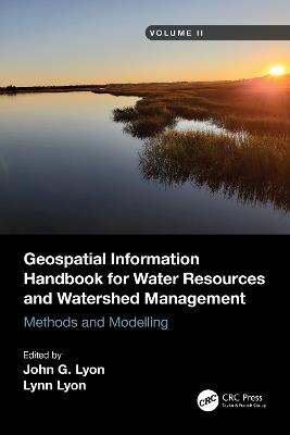
Geospatial Information Handbook for Water Resources and Watershed Management, Volume II: Methods and Modelling
(0)
Cliccando su “Conferma” dichiari che il contenuto da te inserito è conforme alle Condizioni Generali d’Uso del Sito ed alle Linee Guida sui Contenuti Vietati. Puoi rileggere e modificare e successivamente confermare il tuo contenuto. Tra poche ore lo troverai online (in caso contrario verifica la conformità del contenuto alle policy del Sito).
Grazie per la tua recensione!
Tra poche ore la vedrai online (in caso contrario verifica la conformità del testo alle nostre linee guida). Dopo la pubblicazione per te +4 punti ![]()
102,10 €
+1020
punti 
Venditore: IBS
Articolo acquistabile con Carta del Docente

Articolo acquistabile con Carta Cultura Giovani e Carta del Merito

Paga con Klarna in 3 rate senza interessi per ordini superiori a 39 €

Dati e Statistiche
 Salvato in 0 liste dei desideri
Geospatial Information Handbook for Water Resources and Watershed Management, Volume II: Methods and Modelling
Disponibilità in 2 settimane
102,10 €
102,10 €
Disponibilità in 2 settimane
Altre offerte vendute e spedite dai nostri venditori
Libri in Inglese
Geospatial Information Handbook for Water Resources and Watershed Management, Volume II: Methods and Modelling
Altri venditori
Prezzo e spese di spedizione

Nuovo
 disponibilità in 2 settimane
 Venduto e spedito da
IBS
Venduto e spedito da
IBS
Spedizione Gratis
102,10 €
Altri venditori
Prezzo e spese di spedizione
Nuovo
disponibilità in 2 settimane
Venduto e spedito da
IBS
Spedizione Gratis
102,10 €
Altri venditori
Prezzo e spese di spedizione
Tutti i formati ed edizioni
Promo attive (0)
Volume II of Geospatial Information Handbook for Water Resources and Watershed Management discusses Geospatial Technology (GT) approaches using integrated modeling as applied to advanced water resource assessments. Features include multiple date land cover analyses as change in land cover influences water quality, model sensitivity analyses of DEM resolution and influences on modeling water characteristics like Manning’s n, development of seabed cover classification and sensitivity, and forecasting urban growth over time with climate vulnerability impacts on water. A detailed case study presents a range of water quality issues, all effectively demonstrating GT inputs to water quality studies from headwaters to receiving estuarine waters. Also analyzed are the comparison of evapotranspiration simulation performance by APEX model in dryland and irrigated cropping systems and perspectives on the future of transient storage modeling. Captures advanced technologies and applications for implementation with models to address a broad spectrum of water issues Provides real-world applications and case studies using advanced spectral and spatial sensors combined with geospatially facilitated water process models Features a Neuse River Basin case study integrating hydrologic methods and modeling along with remote sensing and GIS technologies for nonpoint source water quality evaluations Global coverage with applications demonstrated by more than 170 experts from around the world This handbook is a wide-ranging and contemporary reference of advanced geospatial techniques used in numerous practical applications at the local and regional scale and is an in-depth resource for professionals and the water research community worldwide.
Leggi di più
Leggi di meno
Curatore:
Editore:
Anno:
2024
Rilegatura:
Paperback / softback
Pagine:
266 p.
Testo in English
Dimensioni:
234 x 156 mm
Peso:
510 gr.
EAN:
9781032006512
L'articolo è stato aggiunto al carrello
Informazioni e Contatti sulla Sicurezza dei Prodotti
Le schede prodotto sono aggiornate in conformità al Regolamento UE 988/2023. Laddove ci fossero taluni dati non disponibili per ragioni indipendenti da IBS, vi informiamo che stiamo compiendo ogni ragionevole sforzo per inserirli. Vi invitiamo a controllare periodicamente il sito www.ibs.it per eventuali novità e aggiornamenti.
Per le vendite di prodotti da terze parti, ciascun venditore si assume la piena e diretta responsabilità per la commercializzazione del prodotto e per la sua conformità al Regolamento UE 988/2023, nonché alle normative nazionali ed europee vigenti.
Per informazioni sulla sicurezza dei prodotti, contattare productsafetyibs@feltrinelli.it
L’articolo è stato aggiunto alla lista dei desideri