L’articolo è stato aggiunto alla lista dei desideri
LIBRO INGLESE

 E-mail
 Facebook
 LinkedIn
 Twitter
 WhatsApp
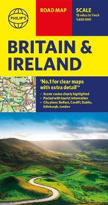
Philip's Britain and Ireland Road Map
(0)
Cliccando su “Conferma” dichiari che il contenuto da te inserito è conforme alle Condizioni Generali d’Uso del Sito ed alle Linee Guida sui Contenuti Vietati. Puoi rileggere e modificare e successivamente confermare il tuo contenuto. Tra poche ore lo troverai online (in caso contrario verifica la conformità del contenuto alle policy del Sito).
Grazie per la tua recensione!
Tra poche ore la vedrai online (in caso contrario verifica la conformità del testo alle nostre linee guida). Dopo la pubblicazione per te +4 punti ![]()
7,12 €

-5%
7,49 €
+70
punti
Venditore: IBS
Articolo acquistabile con Bonus Cultura 18app e Carta del Docente


Articolo acquistabile con Carta Cultura Giovani e Carta del Merito

Dati e Statistiche
 Salvato in 0 liste dei desideri
Philip's Britain and Ireland Road Map
Disponibile in 5 giorni lavorativi
7,12 €
-5%
7,49 €
7,12 €
7,49 €
-5%
Disp. in 5 gg lavorativi

Philip's Britain and Ireland Road Map
Libri in Inglese
Altri venditori
Prezzo e spese di spedizione

Venduto e spedito da IBS
7,12 €
Spedizione gratuita
Altri venditori
Prezzo e spese di spedizione
Venduto e spedito da IBS
7,12 €
Spedizione gratuita
Altri venditori
Prezzo e spese di spedizione
Tutti i formati ed edizioni

Promo attive (0)
'THE BEST OF ITS KIND, WITH QUICK EASY-TO-USE INFORMATION' Fleet Week Philip's super-clear road map of Britain and Ireland, fully updated with the latest route-planning, tourist and driving information. Whether you are planning a road trip of the British Isles or just ensuring you take the best roads from A to B, this map will take you where you wish to go. The bestselling fold-out road map for navigating in Britain and Ireland has been completely updated for all those wanting to go places in the British Isles - England, Scotland, Wales and all of Ireland. Whether driving through the most spectacular scenic routes each country has to offer, working out which county boundary applies, or planning your trip from Edinburgh to London, this handy map has all you need. - Super-clear mapping scale 1:830,000 (13 miles to 1 inch) - Key driving information: motorways (toll, pre-pay and free), mountain routes, railways, canals, road numbers, plus distances between towns - All County Boundaries and Local Councils clearly marked - Fully revised and up-to-date with the latest tourist and leisure information - Scenic routes clearly highlighted from coastal to mountainous - Places of interest: from castles, heritage sites, beaches and national parks to theme parks, places of worship and ancient monuments - Includes the Channel Islands and Isle of Man - Double-sided maps - more for your money and easier to use - Detailed city plans: London, Edinburgh, Cardiff, Dublin and Belfast - Full index of place names In fact, everything you need for going places in Britain and Ireland
Leggi di più
Leggi di meno
Autore:
Editore:
Collana:
Philip's Sheet Maps
Anno:
2020
Rilegatura:
Sheet map
Pagine:
2 p.
Testo in English
Dimensioni:
114 x 42 mm
Peso:
95 gr.
EAN:
9781849075428
L'articolo è stato aggiunto al carrello
L’articolo è stato aggiunto alla lista dei desideri