

L’articolo è stato aggiunto alla lista dei desideri








LIBRO INGLESE
 E-mail
 Facebook
 LinkedIn
 Twitter
 WhatsApp
Priorities for GEOINT Research at the National Geospatial-Intelligence Agency
(0)
Cliccando su “Conferma” dichiari che il contenuto da te inserito è conforme alle Condizioni Generali d’Uso del Sito ed alle Linee Guida sui Contenuti Vietati. Puoi rileggere e modificare e successivamente confermare il tuo contenuto. Tra poche ore lo troverai online (in caso contrario verifica la conformità del contenuto alle policy del Sito).
Grazie per la tua recensione!
Tra poche ore la vedrai online (in caso contrario verifica la conformità del testo alle nostre linee guida). Dopo la pubblicazione per te +4 punti 
67,69 €

-5%
71,25 €
+680
punti
Venditore: IBS
Articolo acquistabile con Carta del Docente

Articolo acquistabile con Carta Cultura Giovani e Carta del Merito

Articolo acquistabile con Carta della Cultura

Paga con Klarna in 3 rate senza interessi per ordini superiori a 39 €

Dati e Statistiche
 Salvato in 0 liste dei desideri
Salvato in 0 liste dei desideri
Priorities for GEOINT Research at the National Geospatial-Intelligence Agency
Disponibile in 5 gg lavorativi
67,69 €
-5%
71,25 €
67,69 €
71,25 €
-5%
Disponibile in 5 gg lavorativi
Altre offerte vendute e spedite dai nostri venditori
Libri in Inglese
Priorities for GEOINT Research at the National Geospatial-Intelligence Agency
Altri venditori
Prezzo e spese di spedizione
LIBRO INGLESE
Disponibile in 5 gg lavorativi

Venduto e spedito da
IBS
Spedizione Gratis
-5%
71,25 €
67,69 €
Altri venditori
Prezzo e spese di spedizione
LIBRO INGLESE
Disponibile in 5 gg lavorativi
Venduto e spedito da
IBS
Spedizione Gratis
-5%
71,25 €
67,69 €
Altri venditori
Prezzo e spese di spedizione

Tutti i formati ed edizioni
Promo attive (0)
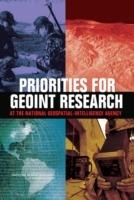
The National Geospatial-Intelligence Agency (NGA) provides geospatial intelligence (GEOINT) to support national security, both as a national intelligence and a combat support agency. In the post-9/11 world, the need for faster and more accurate geospatial intelligence is increasing. GEOINT uses imagery and geospatial data and information to provide knowledge for planning, decisions, and action. For example, data from satellites, pilotless aircraft and ground sensors are integrated with maps and other intelligence data to provide location information on a potential target. This report defines 12 hard problems in geospatial science that NGA must resolve in order to evolve their capabilities to meet future needs. Many of the hard research problems are related to integration of data collected from an ever-growing variety of sensors and non-spatial data sources, and analysis of spatial data collected during a sequence of time (spatio-temporal data). The report also suggests promising approaches in geospatial science and related disciplines for meeting these challenges. The results of this study are intended to help NGA prioritize geospatial science research directions.
Leggi di più
Leggi di meno
Autore:
Editore:
Anno:
2006
Rilegatura:
Paperback / softback
Pagine:
114 p.
Testo in English
Dimensioni:
229 x 152 mm
EAN:
9780309101493

L'articolo è stato aggiunto al carrello
Informazioni e Contatti sulla Sicurezza dei Prodotti
Le schede prodotto sono aggiornate in conformità al Regolamento UE 988/2023. Laddove ci fossero taluni dati non disponibili per ragioni indipendenti da IBS, vi informiamo che stiamo compiendo ogni ragionevole sforzo per inserirli. Vi invitiamo a controllare periodicamente il sito www.ibs.it per eventuali novità e aggiornamenti.
Per le vendite di prodotti da terze parti, ciascun venditore si assume la piena e diretta responsabilità per la commercializzazione del prodotto e per la sua conformità al Regolamento UE 988/2023, nonché alle normative nazionali ed europee vigenti.
Per informazioni sulla sicurezza dei prodotti, contattare productsafetyibs@feltrinelli.it
L’articolo è stato aggiunto alla lista dei desideri
