L’articolo è stato aggiunto alla lista dei desideri


LIBRO INGLESE

 E-mail
 Facebook
 LinkedIn
 Twitter
 WhatsApp
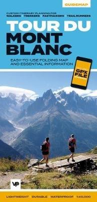
Tour du Mont Blanc: Easy-to-use folding map and essential information, with custom itinerary planning for walkers, trekkers, fastpackers and trail runners
(0)
Cliccando su “Conferma” dichiari che il contenuto da te inserito è conforme alle Condizioni Generali d’Uso del Sito ed alle Linee Guida sui Contenuti Vietati. Puoi rileggere e modificare e successivamente confermare il tuo contenuto. Tra poche ore lo troverai online (in caso contrario verifica la conformità del contenuto alle policy del Sito).
Grazie per la tua recensione!
Tra poche ore la vedrai online (in caso contrario verifica la conformità del testo alle nostre linee guida). Dopo la pubblicazione per te +4 punti ![]()
17,76 €

-5%
18,69 €
+180
punti
Venditore: IBS
Articolo acquistabile con Bonus Cultura 18app e Carta del Docente


Articolo acquistabile con Carta Cultura Giovani e Carta del Merito

Dati e Statistiche
 Salvato in 0 liste dei desideri
Tour du Mont Blanc: Easy-to-use folding map and essential information, with custom itinerary planning for walkers, trekkers, fastpackers and trail runners
Disponibile in 5 giorni lavorativi
17,76 €
-5%
18,69 €
17,76 €
18,69 €
-5%
Disp. in 5 gg lavorativi

Tour du Mont Blanc: Easy-to-use folding map and essential information, with custom itinerary planning for walkers, trekkers, fastpackers and trail runners
Libri in Inglese
Altri venditori
Prezzo e spese di spedizione

Venduto e spedito da IBS
17,76 €
Spedizione gratuita
Altri venditori
Prezzo e spese di spedizione
Venduto e spedito da IBS
17,76 €
Spedizione gratuita
Altri venditori
Prezzo e spese di spedizione
Tutti i formati ed edizioni
Promo attive (0)
The white dome of Mont Blanc looms over France, Italy and Switzerland, and it is no wonder that the 169-kilometre Tour du Mont Blanc (TMB) has captured the public imagination to become one of Europe's most popular long-distance trails. The TMB appeals to people who have different levels of experience and travel at all speeds, and this Vertebrate Publishing Guidemap is unique in that it caters for four categories of user, providing custom itineraries for walkers, trekkers, fastpackers and trail runners. This lightweight, waterproof, durable and easy-to-use folding map features all the essential information for a successful TMB, including 1:40,000-scale mapping for the anticlockwise route starting and finishing in the town of Les Houches, south of Chamonix. It also includes nine route variations, a detailed elevation profile and route planner, safety advice, terrain information and an accommodation directory, and a link to a GPX file download.
Leggi di più
Leggi di meno
Editore:
Collana:
Big Trails Guidemaps
Anno:
2020
Rilegatura:
Sheet map, folded
Pagine:
36 p.
Testo in English
Dimensioni:
242 x 116 mm
Peso:
50 gr.
EAN:
9781912560974
L'articolo è stato aggiunto al carrello
L’articolo è stato aggiunto alla lista dei desideri