L’articolo è stato aggiunto alla lista dei desideri

LIBRO INGLESE

 E-mail
 Facebook
 LinkedIn
 Twitter
 WhatsApp
Zakynthos (Zante) Tour & Trail Map
(0)
Cliccando su “Conferma” dichiari che il contenuto da te inserito è conforme alle Condizioni Generali d’Uso del Sito ed alle Linee Guida sui Contenuti Vietati. Puoi rileggere e modificare e successivamente confermare il tuo contenuto. Tra poche ore lo troverai online (in caso contrario verifica la conformità del contenuto alle policy del Sito).
Grazie per la tua recensione!
Tra poche ore la vedrai online (in caso contrario verifica la conformità del testo alle nostre linee guida). Dopo la pubblicazione per te +4 punti ![]()
13,05 €

-5%
13,74 €
+130
punti
Venditore: IBS
Articolo acquistabile con Bonus Cultura 18app e Carta del Docente


Articolo acquistabile con Carta Cultura Giovani e Carta del Merito

Dati e Statistiche
 Salvato in 0 liste dei desideri
Zakynthos (Zante) Tour & Trail Map
Disponibile in 5 giorni lavorativi
13,05 €
-5%
13,74 €
13,05 €
13,74 €
-5%
Disp. in 5 gg lavorativi

Zakynthos (Zante) Tour & Trail Map
Libri in Inglese
Altri venditori
Prezzo e spese di spedizione

Venduto e spedito da IBS
13,05 €
Spedizione gratuita
Altri venditori
Prezzo e spese di spedizione
Venduto e spedito da IBS
13,05 €
Spedizione gratuita
Altri venditori
Prezzo e spese di spedizione
Tutti i formati ed edizioni

Promo attive (0)
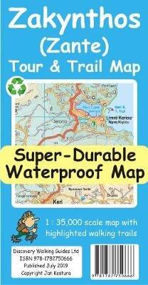
For the best adventures, use the best map. Water-proof, split-proof, tear-proof, adventure-proof. Zakynthos (Zante) Tour & Trail Super-Durable Map is simply the toughest, most accurate, easy to read, easy to use map of the island you can buy at any price. Super-Durable Maps come with a 2 year adventurous use `Wear and Tear' guarantee. A large 840mm by 694mm double sided map sheet has Zakynthos (Zante) at 1:35,000 scale with the North-West of the island on the cover side and the South-East on the reverse. There is a very generous overlap between the two sides so the only time you need to turn the map over is if you are driving from Cape Skinari (NW) to Cape Gerakas (SE) at the opposite end of the island. Our special concertina map fold makes our map easy to use and easy to refold to its 235mm by 120mm pocket size. You can also download the digital Custom Map edition of our Zakynthos Tour & Trail Map for use with Garmin gps units and software; simply follow the instructions on the map sheet. Our legendary 'Tour & Trail' level of detail ranges from major roads to secondary roads to minor roads to streets and narrow country roads, plus dirt roads and walking trails. Place names are in English and Greek to aid your navigation. Altitude shading is designed to clearly show the altitude range when travelling across the island by car or on foot. 100 metre and 20 metre contours are clearly shown on the map along with individual height points and all of the official 'Trig' points. Tour & Trail attention to detail includes our useful symbol range including viewpoints, picnic areas, petrol stations, bar/restaurants and parking areas where you can pull off the road safely. You will easily identify springs, caves, sports grounds, cemeteries, churches, chapels, lighthouses, towers and forts, camping areas, wind turbines, hotels etc. We have ensured that all the walking routes from the Sunflower walking guide book are highlighted (red) on the maps. It all adds up to the most detailed, most durable, most useful map of Zakynthos (Zante) that you can buy anywhere. Digital editions are available for phone apps and Garmin users from the Discovery Walking Guides website.
Leggi di più
Leggi di meno
Autore:
Editore:
Anno:
2019
Rilegatura:
Sheet map
Pagine:
2 p.
Testo in English
Dimensioni:
235 x 120 mm
Peso:
60 gr.
EAN:
9781782750666
L'articolo è stato aggiunto al carrello
L’articolo è stato aggiunto alla lista dei desideri