L’articolo è stato aggiunto alla lista dei desideri
LIBRO INGLESE

 E-mail
 Facebook
 LinkedIn
 Twitter
 WhatsApp
An Historical Map of Swansea & Mumbles: medieval town to Copperopolis
(0)
Cliccando su “Conferma” dichiari che il contenuto da te inserito è conforme alle Condizioni Generali d’Uso del Sito ed alle Linee Guida sui Contenuti Vietati. Puoi rileggere e modificare e successivamente confermare il tuo contenuto. Tra poche ore lo troverai online (in caso contrario verifica la conformità del contenuto alle policy del Sito).
Grazie per la tua recensione!
Tra poche ore la vedrai online (in caso contrario verifica la conformità del testo alle nostre linee guida). Dopo la pubblicazione per te +4 punti ![]()
13,05 €

-5%
13,74 €
+130
punti
Venditore: IBS
Articolo acquistabile con Carta del Docente

Articolo acquistabile con Carta Cultura Giovani e Carta del Merito

Dati e Statistiche
 Salvato in 0 liste dei desideri
An Historical Map of Swansea & Mumbles: medieval town to Copperopolis
Disponibilità in 5 giorni lavorativi
13,05 €
-5%
13,74 €
13,05 €
13,74 €
-5%
Disp. in 5 gg lavorativi
Altre offerte vendute e spedite dai nostri venditori

Libri in Inglese
An Historical Map of Swansea & Mumbles: medieval town to Copperopolis
Altri venditori
Prezzo e spese di spedizione

Nuovo
 disponibilità in 5 giorni lavorativi
 Venduto e spedito da
IBS
Venduto e spedito da
IBS
Spedizione Gratis
-5%
13,74 €
13,05 €
Altri venditori
Prezzo e spese di spedizione
Nuovo
disponibilità in 5 giorni lavorativi
Venduto e spedito da
IBS
Spedizione Gratis
-5%
13,74 €
13,05 €
Altri venditori
Prezzo e spese di spedizione
Tutti i formati ed edizioni

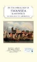
A full colour map, based on digitised OS maps of Swansea of about 1919, with its medieval past overlain and important buildings picked out. The map includes an inset map of Mumbles and its medieval castle. In the Middle Ages, Swansea (Abertawe) became a centre for trade around the mouth of the river Tawe. Following Norman control of the area, Swansea Castle was established in the early 12th century and a borough charter was granted at the end of that century. Great growth began in the 17th century with the establishment of copper-smelting in the area of the lower Tawe valley, an industry which grew until Swansea was the world capital of the copper industry - hence its nickname of 'Copperopolis'. Initially using ore from Cornwall, Swansea took advantage of its local coal resources and its good port facilities to process copper, arsenic, tin, gold and other metals, using imported raw materials from all over the world. The port exported the final products, along with many tons of coal. At the time of the background map shown here, heavy industry and its spoil heaps dominated the lower Tawe valley, and extensive docks dominated the south of the town, but evidence of its medieval past and its street layout survived. The remains of the Norman castle became a workhouse and the course of the river Tawe had been altered to make access for ships easier.
Leggi di più
Leggi di meno
Curatore:
Editore:
Collana:
Town & City Historical Maps
Anno:
2023
Rilegatura:
Sheet map, folded
Pagine:
2 p.
Testo in English
Dimensioni:
206 x 127 mm
EAN:
9781838071929
L'articolo è stato aggiunto al carrello
Informazioni e Contatti sulla Sicurezza dei Prodotti
Le schede prodotto sono aggiornate in conformità al Regolamento UE 988/2023. Laddove ci fossero taluni dati non disponibili per ragioni indipendenti da IBS, vi informiamo che stiamo compiendo ogni ragionevole sforzo per inserirli. Vi invitiamo a controllare periodicamente il sito www.ibs.it per eventuali novità e aggiornamenti.
Per le vendite di prodotti da terze parti, ciascun venditore si assume la piena e diretta responsabilità per la commercializzazione del prodotto e per la sua conformità al Regolamento UE 988/2023, nonché alle normative nazionali ed europee vigenti.
Per informazioni sulla sicurezza dei prodotti, contattare productsafetyibs@feltrinelli.it
L’articolo è stato aggiunto alla lista dei desideri