

L’articolo è stato aggiunto alla lista dei desideri









LIBRO INGLESE
 E-mail
 Facebook
 LinkedIn
 Twitter
 WhatsApp
Offa's Dyke Path Trail Map: Complete 1:25,000 OS Maps for the National Trail route
(0)
Cliccando su “Conferma” dichiari che il contenuto da te inserito è conforme alle Condizioni Generali d’Uso del Sito ed alle Linee Guida sui Contenuti Vietati. Puoi rileggere e modificare e successivamente confermare il tuo contenuto. Tra poche ore lo troverai online (in caso contrario verifica la conformità del contenuto alle policy del Sito).
Grazie per la tua recensione!
Tra poche ore la vedrai online (in caso contrario verifica la conformità del testo alle nostre linee guida). Dopo la pubblicazione per te +4 punti 
15,38 €

-5%
16,19 €
+150
punti
Venditore: IBS
Articolo acquistabile con Carta del Docente

Articolo acquistabile con Carta Cultura Giovani e Carta del Merito

Articolo acquistabile con Carta della Cultura

Dati e Statistiche
 Salvato in 0 liste dei desideri
Salvato in 0 liste dei desideri
Offa's Dyke Path Trail Map: Complete 1:25,000 OS Maps for the National Trail route
Disponibile in 5 gg lavorativi
15,38 €
-5%
16,19 €
15,38 €
16,19 €
-5%
Disponibile in 5 gg lavorativi
Altre offerte vendute e spedite dai nostri venditori

Libri in Inglese
Offa's Dyke Path Trail Map: Complete 1:25,000 OS Maps for the National Trail route
Altri venditori
Prezzo e spese di spedizione
LIBRO INGLESE
Disponibile in 5 gg lavorativi

Venduto e spedito da
IBS
Spedizione Gratis
-5%
16,19 €
15,38 €
Altri venditori
Prezzo e spese di spedizione
LIBRO INGLESE
Disponibile in 5 gg lavorativi
Venduto e spedito da
IBS
Spedizione Gratis
-5%
16,19 €
15,38 €
Altri venditori
Prezzo e spese di spedizione

Tutti i formati ed edizioni
Promo attive (0)
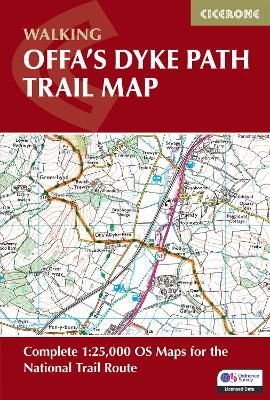
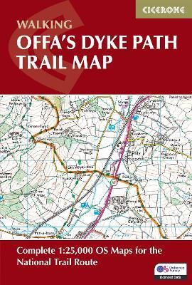
Trace the ancient boundary of Offa's Dyke Path, a 283km (177 mile) National Trail along Britain's longest ancient monument — the 8th-century earthwork separating England and Wales. The trail unfolds through diverse border landscapes, from the dramatic Wye Gorge and Tintern Abbey near Chepstow, across the remote Black Mountains and Hergest Ridge, to the industrial heritage of the Clwydian Range and the seaside finish at Prestatyn. This trail map charts the Offa's Dyke Path from south to north and offers walkers of all abilities the chance to explore limestone gorges, mountain ridges, and borderland heritage over 12–14 days. Providing precise route-line mapping, it ensures you can follow Offa's ancient frontier with total confidence. 1:25,000 OS trail map with Ordnance Survey Explorer map legend Shows the full 177-mile (283km) route of the Offa's Dyke Path Route divided into 12 clearly defined stages of 17–29km (11–18 miles) with route stats for walking the trail in either direction Downloadable GPX files for easy navigation using GPS devices or smartphone apps Available with the Cicerone guidebook Offa's Dyke Path or as a separate, standalone purchase With expert guidance from author Mike Dunn, discover the timeless allure of Britain's borderlands, where every ridge reveals panoramic views, ancient history, and the quiet satisfaction of completing one of the National Trails.
Leggi di più
Leggi di meno
Testo in English
Dimensioni:
172 x 116 mm
Peso:
100 gr.
EAN:
9781786312808

L'articolo è stato aggiunto al carrello
Informazioni e Contatti sulla Sicurezza dei Prodotti
Le schede prodotto sono aggiornate in conformità al Regolamento UE 988/2023. Laddove ci fossero taluni dati non disponibili per ragioni indipendenti da IBS, vi informiamo che stiamo compiendo ogni ragionevole sforzo per inserirli. Vi invitiamo a controllare periodicamente il sito www.ibs.it per eventuali novità e aggiornamenti.
Per le vendite di prodotti da terze parti, ciascun venditore si assume la piena e diretta responsabilità per la commercializzazione del prodotto e per la sua conformità al Regolamento UE 988/2023, nonché alle normative nazionali ed europee vigenti.
Per informazioni sulla sicurezza dei prodotti, contattare productsafetyibs@feltrinelli.it
L’articolo è stato aggiunto alla lista dei desideri
